IMAGES TAKEN NEAR TO
Shore Road, NEWTOWNABBEY, BT37 0PS

Introduction

This page details the photographs taken nearby to Shore Road, BT37 0PS by members of the Geograph project.

The Geograph project started in 2005 with the aim of publishing, organising and preserving representative images for every square kilometre of Great Britain, Ireland and the Isle of Man.

There are currently over 7.5m images from over14,400 individuals and you can help contribute to the project by visiting https://www.geograph.org.uk

Image Map


Images are licensed for reuse under creativecommons.org/licenses/by-sa/2.0
Notes
  • Clicking on the map will re-center to the selected point.
  • The higher the marker number, the further away the image location is from the centre of the postcode.

Image Listing (49 Images Found)

Images are licensed for reuse under creativecommons.org/licenses/by-sa/2.0
  • ...
Image
Details
Distance
1
University of Ulster at Jordanstown
The University has 4 campuses. The 114-acre Jordanstown campus is situated in the borough of Newtownabbey, a few miles to the north of Belfast. This is the main entrance (before term starts!)
Image: © Jackie Proven Taken: 10 Jan 2006
0.09 miles
2
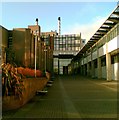
Jordanstown campus, Ulster University
The Jordanstown campus of Ulster University https://en.wikipedia.org/wiki/Ulster_University .
Image: © Rossographer Taken: 15 Jun 2017
0.10 miles
3
Sign at University of Ulster
Sign at the main entrance to the University of Ulster at Jordanstown
Image: © Albert Thompson Taken: 3 Jan 2009
0.10 miles
4
Not too many of these around
A rare sight in this part of the world, a motorcycle with Lebanese plates. Seen while cycling through the Jordanstown campus.
Image: © Robert Ashby Taken: 28 Oct 2015
0.11 miles
5
Postbox, Jordanstown
Indoor pillar box (BT37 45) inside the Ulster University campus at Jordanstown Image
Image: © Rossographer Taken: 15 Jun 2017
0.16 miles
6
Reserved line, Jordanstown/Greenisland (1)
The Shore Road, at Jordanstown, looking towards Carrickfergus along the land reserved for the road widening. The entrance to The Grange Image is at middle left.
Image: © Albert Bridge Taken: 16 Feb 2012
0.17 miles
7
The Grange, Jordanstown, Newtownabbey
Houses on the north western side of the Shore Road (foreground). The grass and bushes mark the line reserved for the new road although, at the time of their construction, it was far from certain what form the road might take or that it would ever be built.
Image: © Albert Bridge Taken: 16 Feb 2012
0.17 miles
8
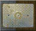
Manhole, Jordanstown
"B.W.W." (presume Belfast Water Works) meter cover at the Jordanstown campus of Ulster University Image; it was cast by Davidson and Co. of Belfast. Particularly unusual as it is indoors - hence the surrounding two-tone carpet; it was one of many along the main central corridor at the campus.
Image: © Rossographer Taken: 15 Jun 2017
0.17 miles
9
Road construction, Jordanstown (3)
Construction of the new road at The Grange, looking towards Carrickfergus, along what had been the reserved line.
Image: © Albert Bridge Taken: 1 Dec 2013
0.17 miles
10
The Grange, Jordanstown (2013-1)
Starting to clear the reserved line at entrance to The Grange Image on the Shore Road. The view is towards Carrickfergus.
Image: © Albert Bridge Taken: 4 May 2013
0.17 miles
  • ...