IMAGES TAKEN NEAR TO
Tate Road, NEWRY, BT35 9YB
Introduction
This page details the photographs taken nearby to Tate Road, BT35 9YB by members of the Geograph project.
The Geograph project started in 2005 with the aim of publishing, organising and preserving representative images for every square kilometre of Great Britain, Ireland and the Isle of Man.

There are currently over 7.5m images from over14,400 individuals and you can help contribute to the project by visiting https://www.geograph.org.uk
Image Map
Images are licensed for reuse under creativecommons.org/licenses/by-sa/2.0
Notes
- Clicking on the map will re-center to the selected point.
- The higher the marker number, the further away the image location is from the centre of the postcode.
Image Listing (10 Images Found)
Images are licensed for reuse under creativecommons.org/licenses/by-sa/2.0
Image
Details
Distance
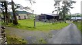
1
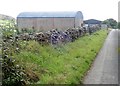
Farm sheds alongside the Aughanduff Road
Image: © Eric Jones
Taken: 12 Sep 2018
0.19 miles
2
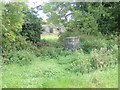
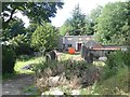
Roofless cottage off Aughanduff Road
This is an area of many abandoned cottages reflecting the prolonged period of rural depopulation in South Armagh. On the other hand it is also an area with many newbuilt houses and cottages which reflects a more recent trend made possible by almost universal car ownership of a preference for country living by people who work in towns.
Image: © Eric Jones
Taken: 12 Sep 2018
0.19 miles
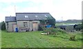
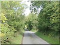
4
Sheds on the Aughanduff Road
Slievenacappel Mountain forms the background.
Image: © Eric Jones
Taken: 12 Sep 2018
0.19 miles
5
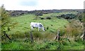
Rough grazing on intake land on the slopes of Aughanduff Lower Mountain
Image: © Eric Jones
Taken: 12 Sep 2018
0.21 miles
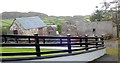
7
Farm buildings on either side of Aughanduff Road
Image: © Eric Jones
Taken: 12 Sep 2018
0.23 miles
8
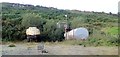
Oil storage tanks in an old quarry on Aughanduff Road
Image: © Eric Jones
Taken: 12 Sep 2018
0.23 miles
9
Roofless house on Aughanduff Road
This house, pictured on Google Street View, is currently being refurbished.
https://www.instantstreetview.com/@54.143342,-6.513358,236.42h,-1.75p,1z
Image: © Eric Jones
Taken: 12 Sep 2018
0.23 miles
10
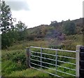
Scrubland on Aughanduff Lower Mountain
The gate, leading from Aughanduff Road, gives access to the mountain which is part of the Ring of Gullion.
Image: © Eric Jones
Taken: 12 Sep 2018
0.23 miles