IMAGES TAKEN NEAR TO
Cashel Road, NEWRY, BT35 9NN
Introduction
This page details the photographs taken nearby to Cashel Road, BT35 9NN by members of the Geograph project.
The Geograph project started in 2005 with the aim of publishing, organising and preserving representative images for every square kilometre of Great Britain, Ireland and the Isle of Man.

There are currently over 7.5m images from over14,400 individuals and you can help contribute to the project by visiting https://www.geograph.org.uk
Image Map
Images are licensed for reuse under creativecommons.org/licenses/by-sa/2.0
Notes
- Clicking on the map will re-center to the selected point.
- The higher the marker number, the further away the image location is from the centre of the postcode.
Image Listing (15 Images Found)
Images are licensed for reuse under creativecommons.org/licenses/by-sa/2.0
Image
Details
Distance
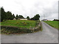
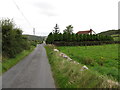
1
Farm buildings on the west side of Cashel Road
Image: © Eric Jones
Taken: 2 Sep 2014
0.02 miles
4
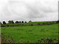
Agricultural land on the southwest side of the middle section of Cashel Road
Image: © Eric Jones
Taken: 2 Sep 2014
0.11 miles
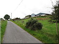
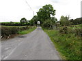
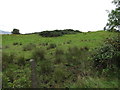
6
Field barn on the ridge west of Cashel Road
Image: © Eric Jones
Taken: 2 Sep 2014
0.13 miles
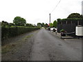
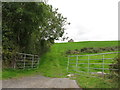
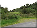
8
Rough grazing on the east side of Cashel Road
Image: © Eric Jones
Taken: 2 Sep 2014
0.17 miles
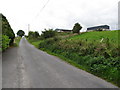
9
Grazing land on Ballinasack Road, Mullaghbawn
The summit of Cashel can be seen in the background.
Image: © Eric Jones
Taken: 2 Sep 2014
0.18 miles