IMAGES TAKEN NEAR TO
Glassdrumman Road, NEWRY, BT35 9EA
Introduction
This page details the photographs taken nearby to Glassdrumman Road, BT35 9EA by members of the Geograph project.
The Geograph project started in 2005 with the aim of publishing, organising and preserving representative images for every square kilometre of Great Britain, Ireland and the Isle of Man.

There are currently over 7.5m images from over14,400 individuals and you can help contribute to the project by visiting https://www.geograph.org.uk
Image Map
Images are licensed for reuse under creativecommons.org/licenses/by-sa/2.0
Notes
- Clicking on the map will re-center to the selected point.
- The higher the marker number, the further away the image location is from the centre of the postcode.
Image Listing (16 Images Found)
Images are licensed for reuse under creativecommons.org/licenses/by-sa/2.0
Image
Details
Distance
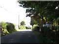
1
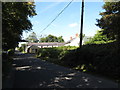
Farmhouse and buildings on the Glasdrumman Road
Image: © Eric Jones
Taken: 10 Sep 2014
0.01 miles
2
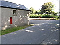
Former Post Office building on the Glasdrumman Road
All that remains today is the pipe mounted post box. In 2011 there was a modern phone box by the corner of the post office building.
Image: © Eric Jones
Taken: 10 Sep 2014
0.01 miles
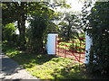
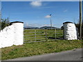
4
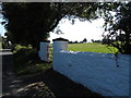
White-washed field gate pillars on the Glasdrumman Road
This one of number of such painted gate posts along this stretch of Glasdrumman Road. These have been painted since Google Street View visited the area in 2011.
Image: © Eric Jones
Taken: 10 Sep 2014
0.09 miles
5
Painted field gates on the Glasdrumman Road
The camera points eastwards. This one of number of such painted gate posts along this stretch of Glasdrumman Road. These have been painted since Google Street View visited the area in 2011.
Image: © Eric Jones
Taken: 10 Sep 2014
0.11 miles
6
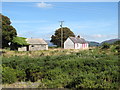
Homestead on the Glasdrumman Road
This homestead borders on to the south-eastern shores of Glasdrumman Lough.
Image: © Eric Jones
Taken: 10 Sep 2014
0.17 miles
7
Red painted gates on the south side of Glasdrumman Road
This one of number of such painted gate posts along this stretch of Glasdrumman Road. These have been painted since Google Street View visited the area in 2011.
Image: © Eric Jones
Taken: 10 Sep 2014
0.18 miles
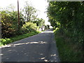
8
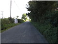
Telephone line along the Glasdrumman Road
Image: © Eric Jones
Taken: 10 Sep 2014
0.18 miles
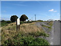
9
Gate-posts near the Glasdrumman Road/Leeter Road junction
This one of number of such painted gate posts along this stretch of Glasdrumman Road. These have been painted since Google Street View visited the area in 2011. Slieve Gullion and Croslieve Mountain can be seen in the background.
Image: © Eric Jones
Taken: 10 Sep 2014
0.21 miles
10
A Poets' Trail Information Board above Glasdrumman Lough
One of the main Poets' Trails, linking Castle Roche and Creggan graveyard passes along Glasdrumman Road.
Image]
Image]
Image: © Eric Jones
Taken: 10 Sep 2014
0.21 miles