IMAGES TAKEN NEAR TO
Monog Road, NEWRY, BT35 9DH
Introduction
This page details the photographs taken nearby to Monog Road, BT35 9DH by members of the Geograph project.
The Geograph project started in 2005 with the aim of publishing, organising and preserving representative images for every square kilometre of Great Britain, Ireland and the Isle of Man.

There are currently over 7.5m images from over14,400 individuals and you can help contribute to the project by visiting https://www.geograph.org.uk
Image Map
Images are licensed for reuse under creativecommons.org/licenses/by-sa/2.0
Notes
- Clicking on the map will re-center to the selected point.
- The higher the marker number, the further away the image location is from the centre of the postcode.
Image Listing (16 Images Found)
Images are licensed for reuse under creativecommons.org/licenses/by-sa/2.0
Image
Details
Distance
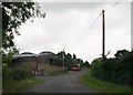
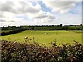
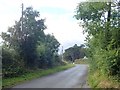
2
View South-eastwards along Monog Road
This is a section of Monog Road between the Alley Road junction and the Liscalgot Road junction.
Image: © Eric Jones
Taken: 6 Sep 2019
0.11 miles
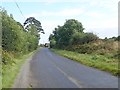
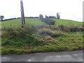
3
An unusual col in a drumlin ridge above the Manog Road
This could have been the result of gravel working.
Image: © Eric Jones
Taken: 24 Sep 2018
0.13 miles
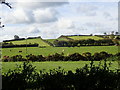
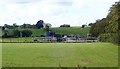
4
Farm buildings on the Monog Road
The image was taken from Liscalgot Road.
Image: © Eric Jones
Taken: 24 Sep 2018
0.13 miles
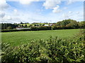
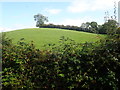
5
Grazing land on the West side of Liscalgot Road
Image: © Eric Jones
Taken: 24 Sep 2018
0.20 miles
7
The Creggan Sewage Works viewed from the Liscalgot Road
Image: © Eric Jones
Taken: 24 Sep 2018
0.21 miles
8
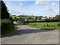
Monog Road at its junction with Liscalgot Road
Image: © Eric Jones
Taken: 24 Sep 2018
0.21 miles
9
Monog Road approaching the Alley Road junction
Image: © Eric Jones
Taken: 6 Sep 2019
0.21 miles
10
Drummuck Rath viewed from Alley Road
The Drummuck Rath consists of an oval platform. It is highest on its Northern edge which overlooks a steep scarp and is enclosed by a bank.
https://apps.communities-ni.gov.uk/NISMR-PUBLIC/Details.aspx?MonID=6102
Image: © Eric Jones
Taken: 6 Sep 2019
0.21 miles