
IMAGES TAKEN NEAR TO
Mountain Road, NEWRY, BT35 8TB
Introduction
This page details the photographs taken nearby to Mountain Road, BT35 8TB by members of the Geograph project.
The Geograph project started in 2005 with the aim of publishing, organising and preserving representative images for every square kilometre of Great Britain, Ireland and the Isle of Man.

There are currently over 7.5m images from over14,400 individuals and you can help contribute to the project by visiting https://www.geograph.org.uk
Image Map
Images are licensed for reuse under creativecommons.org/licenses/by-sa/2.0
Notes
- Clicking on the map will re-center to the selected point.
- The higher the marker number, the further away the image location is from the centre of the postcode.
Image Listing (9 Images Found)
Images are licensed for reuse under creativecommons.org/licenses/by-sa/2.0
Image
Details
Distance
1
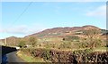
The Western slopes of Slieve Gullion viewed from the Cloghenny Road
Slieve Gullion is the highest mountain in Co Armagh. It is composed of near-horizontal sheets of dolerites interbanded with granophyre formed from the cooling of magma deep underground. This gives Slieve Gullion a somewhat stepped profile.
Image: © Eric Jones
Taken: 3 Dec 2018
0.06 miles
2
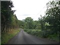
Road linking the Slieve Gullion Forest Drive with the B113 at Drumintee
Image: © Eric Jones
Taken: 21 Aug 2013
0.10 miles
3
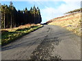
The dead end unnamed road leading from the B113 approaching the junction with the descending Forest Park road
The climb to the junction is a steep one.
Image: © Eric Jones
Taken: 3 Dec 2018
0.11 miles
4
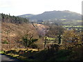
The SE lobe of the Slieve Gullion 'tail'
The harvesting of trees has exposed the boulder clay 'tail' which was previously hidden. This is a part of the Slieve Gullion 'Crag and tail' feature.
https://www.instantstreetview.com/@54.10235,-6.427079,135.25h,-0.68p,1z
Image: © Eric Jones
Taken: 3 Dec 2018
0.15 miles
5
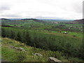
View S towards Forkhill from Slieve Gullion Forest Drive
Image: © Colin Park
Taken: 8 Oct 2013
0.20 miles
6
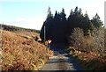
The exit motor road from the Slieve Gullion Forest Park approaching the junction with the two way road descending to the B113
Traffic is one way only on the Forest Park motor roads.
Image: © Eric Jones
Taken: 3 Dec 2018
0.23 miles
7
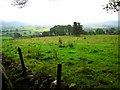
Fields near Slieve Gullion
Looking SSE across fields towards County Louth.
Image: © Rossographer
Taken: 22 Sep 2007
0.23 miles
8
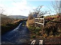
Upper no through road section of the unnamed road running North from the B113
This image was taken from the junction of the descending forest park road which joins the unnamed road at this point. Traffic on the park road is one way only.
Image: © Eric Jones
Taken: 3 Dec 2018
0.24 miles
9
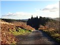
Approaching the junction with an unnamed local access road
The sign warns of two-way traffic beyond the junction.
Image: © Eric Jones
Taken: 3 Dec 2018
0.24 miles