IMAGES TAKEN NEAR TO
Drumintee Road, NEWRY, BT35 8SY
Introduction
This page details the photographs taken nearby to Drumintee Road, BT35 8SY by members of the Geograph project.
The Geograph project started in 2005 with the aim of publishing, organising and preserving representative images for every square kilometre of Great Britain, Ireland and the Isle of Man.

There are currently over 7.5m images from over14,400 individuals and you can help contribute to the project by visiting https://www.geograph.org.uk
Image Map
Images are licensed for reuse under creativecommons.org/licenses/by-sa/2.0
Notes
- Clicking on the map will re-center to the selected point.
- The higher the marker number, the further away the image location is from the centre of the postcode.
Image Listing (23 Images Found)
Images are licensed for reuse under creativecommons.org/licenses/by-sa/2.0
Image
Details
Distance
1
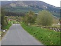
The New Line approaching its junction with Drumintee Road
The forested south facing slope of Slieve Gullion forms the background
Image: © Eric Jones
Taken: 16 May 2013
0.02 miles
2
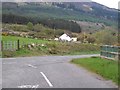
The New Line Road at its junction with Drumintee Road
The forested south facing slope of Slieve Gullion forms the background.
Image: © Eric Jones
Taken: 16 May 2013
0.04 miles
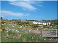
3
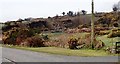
Disused quarry on the western edge of Drumintee village
The image was taken from the B113.
Image: © Eric Jones
Taken: 9 Apr 2018
0.09 miles
4
Sharp bend in the B113 (Newry to Forkhill Road)
The woodland on the left is at Slieve Gullion Forest Park.
Image: © Eric Jones
Taken: 29 Oct 2018
0.10 miles
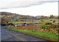
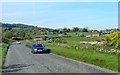
5
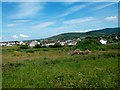
Cattle grazing on fields between the Drumintee Road and the slopes of Slieve Gullion
Image: © Eric Jones
Taken: 16 May 2013
0.10 miles
6
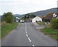
Approaching the shopping centre at Drumintee
This is located on Drumintee Road.
Image: © Eric Jones
Taken: 16 May 2013
0.10 miles
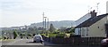
7
Sweeping curve in the B113 (Drumintee Road)
Image: © Eric Jones
Taken: 14 May 2019
0.10 miles
10
View SSW along Low Road, Drumintee
St Patrick's Chapel can be seen on the left set off against the background of Tievecrom Hill.
Image: © Eric Jones
Taken: 14 May 2019
0.13 miles