IMAGES TAKEN NEAR TO
Barcroft Park, NEWRY, BT35 8ER

Introduction

This page details the photographs taken nearby to Barcroft Park, BT35 8ER by members of the Geograph project.

The Geograph project started in 2005 with the aim of publishing, organising and preserving representative images for every square kilometre of Great Britain, Ireland and the Isle of Man.

There are currently over 7.5m images from over14,400 individuals and you can help contribute to the project by visiting https://www.geograph.org.uk

Image Map


Images are licensed for reuse under creativecommons.org/licenses/by-sa/2.0
Notes
  • Clicking on the map will re-center to the selected point.
  • The higher the marker number, the further away the image location is from the centre of the postcode.

Image Listing (38 Images Found)

Images are licensed for reuse under creativecommons.org/licenses/by-sa/2.0
  • ...
Image
Details
Distance
1
A surviving remnant of Victorian housing in Barcroft Park
These contrast in style with the surrounding modern housing estates built by both the Northern Ireland Housing Executive and private developers.
Image: © Eric Jones Taken: 19 Apr 2014
0.05 miles
2
Descending Barcroft Park Road
This stretch of road provides a fine view of the city centre.
Image: © Eric Jones Taken: 19 Apr 2014
0.08 miles
3
Dissident Republican graffiti in Barcroft Park
Image: © Eric Jones Taken: 19 Apr 2014
0.08 miles
4
Houses in Ardgreen Drive, Barcroft Park, Newry
These houses overlook the city centre.
Image: © Eric Jones Taken: 19 Apr 2014
0.09 miles
5
Housing in Barcroft Park, Newry
Image: © Eric Jones Taken: 19 Apr 2014
0.10 miles
6
View west across the centre of Newry towards Camlough Mountain
Image: © Eric Jones Taken: 4 Feb 2015
0.11 miles
7
Houses on Barcroft Park Road
Image: © Eric Jones Taken: 19 Apr 2014
0.12 miles
8
St Catherine's Dominican Priory, Newry
Image: © Eric Jones Taken: 11 Apr 2018
0.13 miles
9
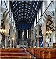
The interior of St Catherine's Dominican Chapel, Newry
This church was consecrated in October 1875.
Image: © Eric Jones Taken: 11 Apr 2018
0.14 miles
10
Houses with a view in Loanda Crescent, Newry
The view includes the fiord-like Newry River-Carlingford Lough trough and the towering Cooley Mountains as well as (out of this picture) the Mourne Mountains of Co Down. Image]
Image: © Eric Jones Taken: 19 Apr 2014
0.14 miles
  • ...