1
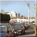
View south along Patrick Street from the Barcroft Park junction
The church on the right is St Catherine’s Priory, a Dominican church in Dominic Street.
Image: © Eric Jones
Taken: 19 Apr 2014
0.01 miles
2
View North along Patrick Street, Newry
The buildings in the background are those of the Southern Regional College - Newry Campus.
Image: © Eric Jones
Taken: 16 Nov 2016
0.02 miles
3
The junction of Barcroft Park and Patrick Street, Newry
The Canal Court Hotel can be seen in the gap between the houses.
Image: © Eric Jones
Taken: 19 Apr 2014
0.02 miles
4
New Spar Store at the junction of Barcroft Park and Patrick Street
Image: © Eric Jones
Taken: 19 Apr 2014
0.03 miles
5
Imposing semi in Raymond Kelly Park, Newry
The street is named after a young Newry merchant seaman Thomas Raymond Kelly GC (1928-1947) who drowned while attempting to rescue the crew of the stricken SS Famagusta in the Bay of Biscay in March 1947. The following day would have been his 19th birthday.
http://www.hidden-gems.eu/down%20-%20kelly%20GC.pdf
Image: © Eric Jones
Taken: 19 Apr 2014
0.03 miles
6
The Raymond McCreesh Children's Playground
This Council playground is named after the Maze Prison Hunger Striker Raymond McCreesh. Its naming is strongly opposed by the Unionist minority on the Newry Mourne Down Council.
http://www.bbc.co.uk/news/uk-northern-ireland-31703859
Image: © Eric Jones
Taken: 11 Apr 2018
0.05 miles
7
Disused business premises on the corner of Patrick Street and Kiln Street
This used to be McDonald's Newsagent and Confectionery store.
Image: © Eric Jones
Taken: 16 Nov 2016
0.05 miles
8
The rear of Michael Mallin Park in Patrick Street
In the foreground is the Raymond McCreesh Children's playground.
Image]
Image: © Eric Jones
Taken: 11 Apr 2018
0.05 miles
9
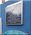
A plaque on the edge of Michael Mallin Park to commemorate the Irish Citizens Army
The ICA was set up by James Connolly during the Great Dublin Lockout of 1913 and later fought in the Easter Rising of Easter 1916. Michael Mallin, after which the nearby housing estate was named, was a former soldier in the 21st Royal Scots Fusiliers who became 2i/c of the Irish Citizens Army. For his role in the Easter Rising he was executed by firing squad on 8 May 1916
Image: © Eric Jones
Taken: 11 Apr 2018
0.05 miles
10
Looking down Mill Street to Domnic Street
Image: © HENRY CLARK
Taken: 12 Sep 2009
0.06 miles


