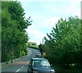
IMAGES TAKEN NEAR TO
Millvale Park, NEWRY, BT35 7NL

Introduction

This page details the photographs taken nearby to Millvale Park, BT35 7NL by members of the Geograph project.

The Geograph project started in 2005 with the aim of publishing, organising and preserving representative images for every square kilometre of Great Britain, Ireland and the Isle of Man.

There are currently over 7.5m images from over14,400 individuals and you can help contribute to the project by visiting https://www.geograph.org.uk

Image Map


Images are licensed for reuse under creativecommons.org/licenses/by-sa/2.0
Notes
  • Clicking on the map will re-center to the selected point.
  • The higher the marker number, the further away the image location is from the centre of the postcode.

Image Listing (13 Images Found)

Images are licensed for reuse under creativecommons.org/licenses/by-sa/2.0
Image
Details
Distance
1
The Millvale Cross Roads on the B133 (Millvale Road), Bessbrook
The large building in the centre of the image is the Millvale Arms. Four members of the RUC were killed by an IRA 1000lbs van bomb close to this point in April 1979.
Image: © Eric Jones Taken: 21 Mar 2019
0.07 miles
2
The Millvale Arms viewed from Kidd's Road
Public houses (pawn shops and police stations) were not permitted to be built in the mill village of Bessbrook by its Quaker founder John Grubb Richardson. The neighbouring hamlet of Millvale however was outside his jurisdiction and the Millvale Arms, known locally as The Pit, thrived.
Image: © Eric Jones Taken: 21 Mar 2019
0.07 miles
3
Traffic preparing to exit Kidd's Road for Millvale Road, Newry
Image: © Eric Jones Taken: 16 May 2014
0.09 miles
4
Millvale Road crossing the Bessbrook River
The Bessbrook River is a tributary of the Newry River.
Image: © Eric Jones Taken: 21 Mar 2019
0.10 miles
5
Bessbrook River Bridge on Millvale Road, Bessbrook
Image: © Eric Jones Taken: 21 Mar 2019
0.11 miles
6
Kidd's Road, Millvale
This leads under the main line railway into the northern suburbs of Newry. The bridge in the foreground spans the Bessbrook River.
Image: © Eric Jones Taken: 21 Mar 2019
0.11 miles
7
The northernmost section of the Slieve Gullion Trail
This section leading into Newry passes under the Craigmore Viaduct.
Image: © Eric Jones Taken: 16 May 2014
0.12 miles
8
Craigmore section of the Sustrans 9
This route which passes under the Craigmore Viaduct (seen here in the background) links Bessbrook and Newry.
Image: © Eric Jones Taken: 21 Mar 2019
0.12 miles
9
Farmhouse and outbuildings above the Millvale Road at Bessbrook
Image: © Eric Jones Taken: 21 Mar 2019
0.13 miles
10
Millvale Road, Newry
Image: © James Emmans Taken: 13 Sep 2015
0.15 miles