IMAGES TAKEN NEAR TO
Carrickgallogly Lane, NEWRY, BT35 7FN
Introduction
This page details the photographs taken nearby to Carrickgallogly Lane, BT35 7FN by members of the Geograph project.
The Geograph project started in 2005 with the aim of publishing, organising and preserving representative images for every square kilometre of Great Britain, Ireland and the Isle of Man.

There are currently over 7.5m images from over14,400 individuals and you can help contribute to the project by visiting https://www.geograph.org.uk
Image Map
Images are licensed for reuse under creativecommons.org/licenses/by-sa/2.0
Notes
- Clicking on the map will re-center to the selected point.
- The higher the marker number, the further away the image location is from the centre of the postcode.
Image Listing (12 Images Found)
Images are licensed for reuse under creativecommons.org/licenses/by-sa/2.0
Image
Details
Distance
1
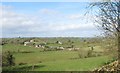
Drumlin topography north of Carrowmannan Road
This is the basket of eggs topography which extends westwards between the coast of Co Down and Donegal Bay.
Image: © Eric Jones
Taken: 14 Mar 2017
0.07 miles
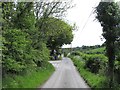
2
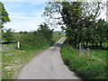
Local access lane running to Carrickananny
Image: © Eric Jones
Taken: 16 May 2014
0.08 miles
3
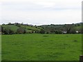
Drumlins overlooking the Carrickgallogy Road
Image: © Eric Jones
Taken: 16 May 2014
0.11 miles
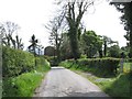
4
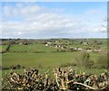
Houses on Carrickgallogly Road
The image was taken from the Carrowmannan Road.
Image: © Eric Jones
Taken: 14 Mar 2017
0.11 miles
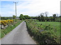
5
Approaching a junction on the Carrickgallogly Road
The junction is with an access lane linking it with Carrickananny Road.
Image: © Eric Jones
Taken: 16 May 2014
0.12 miles
6
View east along an access lane linking Carrickgallogly Road and Carrickananny Road
This traverses the deep countryside north of the village of Belleek.
Image: © Eric Jones
Taken: 16 May 2014
0.13 miles
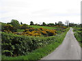
7
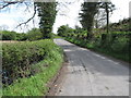
Dangerous bends on the Carrickgallogly Road
Image: © Eric Jones
Taken: 16 May 2014
0.18 miles
8
Carrickgallogly Road approaching a right hand junction with a private farm road
Image: © Eric Jones
Taken: 16 May 2014
0.18 miles
9
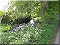
A tributary of the Cusher River
The Cusher flows north-eastwards to join the Bann just south of the later's entry into Lough Neagh.
Image: © Eric Jones
Taken: 16 May 2014
0.19 miles
10
Sheep pastures north of Carrickgallogly Road
Image: © Eric Jones
Taken: 16 May 2014
0.21 miles