IMAGES TAKEN NEAR TO
Cashel Close, NEWRY, BT35 7DU
Introduction
This page details the photographs taken nearby to Cashel Close, BT35 7DU by members of the Geograph project.
The Geograph project started in 2005 with the aim of publishing, organising and preserving representative images for every square kilometre of Great Britain, Ireland and the Isle of Man.

There are currently over 7.5m images from over14,400 individuals and you can help contribute to the project by visiting https://www.geograph.org.uk
Image Map
Images are licensed for reuse under creativecommons.org/licenses/by-sa/2.0
Notes
- Clicking on the map will re-center to the selected point.
- The higher the marker number, the further away the image location is from the centre of the postcode.
Image Listing (58 Images Found)
Images are licensed for reuse under creativecommons.org/licenses/by-sa/2.0
Image
Details
Distance
1
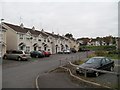
Cloughan Court, Camlough
This is an estate between the A25 and Chapel Road.
Image: © Eric Jones
Taken: 2 Sep 2014
0.03 miles
2
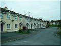
Modern terraced housing at Cloughan Court, Camlough
Image: © Eric Jones
Taken: 2 Sep 2014
0.03 miles
3
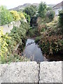
A canalised section of the Camlough River diverted round the back of a row of semi-detached houses
At the centre of the village the Camlough River resumes its natural course with well developed meanders towards the village of Bessbrook.
Image: © Eric Jones
Taken: 18 Sep 2019
0.06 miles
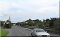
5
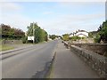
Houses on the A25 at Camlough
The bridge in the foreground, providing access to a house, spans the canalised Camlough River.
Image: © Eric Jones
Taken: 18 Sep 2019
0.09 miles
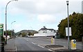
6
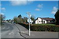
Chapel Road, Camlough at its junction with the A25 (Newry Road)
The building on the right is St Malachy's Primary School.
Image: © Eric Jones
Taken: 2 Sep 2014
0.10 miles
7
Chapel Hill descending to its junction with Camlough Road
Image: © Eric Jones
Taken: 30 Apr 2013
0.10 miles
8
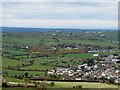
The western outskirts of Camlough from the Mountain Road
Image: © Eric Jones
Taken: 11 Apr 2014
0.10 miles
9
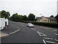
The Camlough Road approaching the roundabout at the junction with Chapel Road
The village bus shelter can be seen on the right.
Image: © Eric Jones
Taken: 15 May 2012
0.11 miles
10
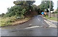
Surface Water at the junction of McCrink's Lane and the A25 at Camlough
NI Water workmen in attendance.
Image: © Eric Jones
Taken: 18 Sep 2019
0.11 miles