
IMAGES TAKEN NEAR TO
Orior Park, NEWRY, BT35 7BT
Introduction
This page details the photographs taken nearby to Orior Park, BT35 7BT by members of the Geograph project.
The Geograph project started in 2005 with the aim of publishing, organising and preserving representative images for every square kilometre of Great Britain, Ireland and the Isle of Man.

There are currently over 7.5m images from over14,400 individuals and you can help contribute to the project by visiting https://www.geograph.org.uk
Image Map
Images are licensed for reuse under creativecommons.org/licenses/by-sa/2.0
Notes
- Clicking on the map will re-center to the selected point.
- The higher the marker number, the further away the image location is from the centre of the postcode.
Image Listing (40 Images Found)
Images are licensed for reuse under creativecommons.org/licenses/by-sa/2.0
Image
Details
Distance
1
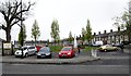
Charlemont Square, Bessbrook
Bessbrook was designed as a model village established around linen mills owned by a Quaker entrepreneur John Grubb Richardson.
Image: © Eric Jones
Taken: 15 May 2012
0.09 miles
2
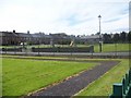
College Square Bessbrook
College Square, was named after the primary school - built in 1849 - which was, for its time, an upmarket school. The boys and girls were taught separately and the teachers resided on either side of the school premises.
Image: © HENRY CLARK
Taken: 22 May 2009
0.10 miles
3
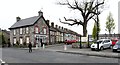
The west side of Charlemont Square, Bessbrook
Image: © Eric Jones
Taken: 15 May 2012
0.11 miles
4
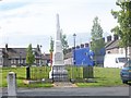
Bessbrook War Memorial in Charlemont Square
Bessbrook War Memorial is located in Charlemont Square in the middle of the village.
The memorial, on which are the names of 86 men of the village who made the supreme sacrifice, takes the form of an obelisk. It is over 17 feet (5.75m) tall and is made from white marble and Newry granite and occupies a central site in the village.
The massive base, check and chamber, with patent axed finish supports a richly molded base and deeply paneled die with the top of octagonal and four sides enhanced with graceful swags of carving. Supporting the die is a beautifully draped spire with central shield bearing in relief the dates 1914-18.
410 men from Bessbrook and district joining up. Many of these young men in the pride of their youth left that happy and peaceful country village and everything that was near and dear to them to answer the call of their King and Country in the time of danger, and of that 410 men, 86 never returned.
Image: © HENRY CLARK
Taken: 22 May 2009
0.12 miles
6
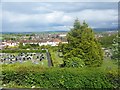
A view of the village from Bessbrook Presbyterian Church
Image: © HENRY CLARK
Taken: 22 May 2009
0.12 miles
8
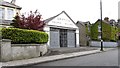
A disused draper and milliner shop in Church Street
W.J. Griffith's shop is listed in a street directory for 1910 and the business was probably much older than that.
Image: © Eric Jones
Taken: 15 May 2012
0.13 miles
9
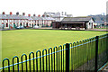
The Clubhouse
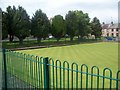
The clubhouse and bowling green of Bessbrook Bowling Club at College Square.
Image: © William England
Taken: 14 Feb 2009
0.13 miles
10
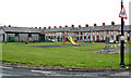
Playground
Children's playground in College Square, Bessbrook
Image: © William England
Taken: 14 Feb 2009
0.13 miles