
IMAGES TAKEN NEAR TO
Acton Road, NEWRY, BT35 6TB
Introduction
This page details the photographs taken nearby to Acton Road, BT35 6TB by members of the Geograph project.
The Geograph project started in 2005 with the aim of publishing, organising and preserving representative images for every square kilometre of Great Britain, Ireland and the Isle of Man.

There are currently over 7.5m images from over14,400 individuals and you can help contribute to the project by visiting https://www.geograph.org.uk
Image Map
Images are licensed for reuse under creativecommons.org/licenses/by-sa/2.0
Notes
- Clicking on the map will re-center to the selected point.
- The higher the marker number, the further away the image location is from the centre of the postcode.
Image Listing (6 Images Found)
Images are licensed for reuse under creativecommons.org/licenses/by-sa/2.0
Image
Details
Distance
1
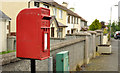
Letter box, Acton near Poyntzpass
Post-mounted EIIR letter box (BT35 180) on the Acton Road.
Image: © Albert Bridge
Taken: 19 May 2012
0.05 miles
2
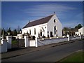
Church of St. Joseph's, Poyntzpass
This church was built around 1794 on ground leased from Alexander Thomas Stewart, who was then developing the village. It could accommodate 500 people. Despite extensive renovations in 1907, 1958, and 1988, it still retains its eighteenth century appearance and charm.
Image: © P Flannagan
Taken: 9 Feb 2008
0.11 miles
3
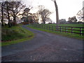
Attractive farm entrance off the Acton Road, Poyntzpass
Image: © P Flannagan
Taken: 10 Nov 2007
0.14 miles
4
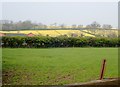
Oilseed rape growing on a drumlin above the Tandragee Road
The image was taken from the Newry Canal Towpath. The bungalow is on the northern outskirts of Poyntzpass.
Image: © Eric Jones
Taken: 18 Apr 2019
0.15 miles
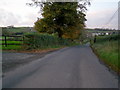
6
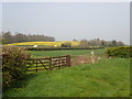
Traffic travelling South along the Tandragee Road
This image was taken from the Newry Canal Towpath.
Image: © Eric Jones
Taken: 18 Apr 2019
0.22 miles