
IMAGES TAKEN NEAR TO
Lir Grove, NEWRY, BT35 0RA
Introduction
This page details the photographs taken nearby to Lir Grove, BT35 0RA by members of the Geograph project.
The Geograph project started in 2005 with the aim of publishing, organising and preserving representative images for every square kilometre of Great Britain, Ireland and the Isle of Man.

There are currently over 7.5m images from over14,400 individuals and you can help contribute to the project by visiting https://www.geograph.org.uk
Image Map
Images are licensed for reuse under creativecommons.org/licenses/by-sa/2.0
Notes
- Clicking on the map will re-center to the selected point.
- The higher the marker number, the further away the image location is from the centre of the postcode.
Image Listing (77 Images Found)
Images are licensed for reuse under creativecommons.org/licenses/by-sa/2.0
Image
Details
Distance
2
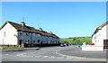
Close on the Dungormley Estate, Newtownhamilton
Image: © Eric Jones
Taken: 3 Jun 2016
0.04 miles
3
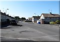
Houses on the Dungormley Estate, Newtownhamilton
Image: © Eric Jones
Taken: 3 Jun 2016
0.07 miles
4
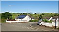
Tullyvallen Fold, Newtownhamillton
These are council owned sheltered housing units for the elderly located off Castleblayney Road.
Image: © Eric Jones
Taken: 7 Jun 2019
0.07 miles
5
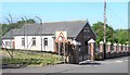
Newtownhamilton Gospel Hall
This is located in Castleblayney Street.
Image: © Eric Jones
Taken: 3 Jun 2016
0.08 miles
6
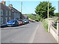
Castleblayney Street, Newtownhamilton
This old road to Castleblayney (now in the Irish Republic) joins the newer A25 Blayney Road a mile or so south-west of the village.
Image: © Eric Jones
Taken: 3 Jun 2016
0.09 miles
7
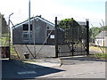
BT Telephone Exchange, Castleblayney Road, Newtownhamilton
For security reasons telephone exchanges in NI have high wire fences topped with razor wire.
Image: © Eric Jones
Taken: 3 Jun 2016
0.09 miles
8
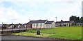
The Newtownhamilton Gospel Hall and Telephone Exchange
The image was taken from the grounds of the adjoining 2nd Newtownhamilton Presbyterian Church.
Image: © Eric Jones
Taken: 8 Aug 2019
0.09 miles
9
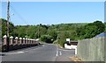
Sharp left hand bend in Castleblayney Street, Newtownhamilton
Here the road departs the village of Newtownhamilton in a westerly direction.
Image: © Eric Jones
Taken: 3 Jun 2016
0.10 miles
10
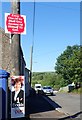
Religious and political messages in Castleblayney Street, Newtownhamilton
Monaghan Road, extending westwards from Castleblayney Street winds its way through an area reaching to and beyond the Border inhabited by Presbyterian farming folk whose ancestors were planted in the area in the 17thC. The political poster features Diane Dodds of the DUP, one of the three sitting MEPs for Northern Ireland.
Image: © Eric Jones
Taken: 7 Jun 2019
0.10 miles