IMAGES TAKEN NEAR TO
Roxborough Road, NEWRY, BT35 0QQ
Introduction
This page details the photographs taken nearby to Roxborough Road, BT35 0QQ by members of the Geograph project.
The Geograph project started in 2005 with the aim of publishing, organising and preserving representative images for every square kilometre of Great Britain, Ireland and the Isle of Man.

There are currently over 7.5m images from over14,400 individuals and you can help contribute to the project by visiting https://www.geograph.org.uk
Image Map
Images are licensed for reuse under creativecommons.org/licenses/by-sa/2.0
Notes
- Clicking on the map will re-center to the selected point.
- The higher the marker number, the further away the image location is from the centre of the postcode.
Image Listing (17 Images Found)
Images are licensed for reuse under creativecommons.org/licenses/by-sa/2.0
Image
Details
Distance
1
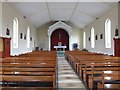
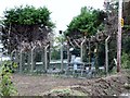
The interior of St Oliver Plunkett's Church, Dorsey, Co Armagh
This chapel serves a large rural area and is in the care of the priest of Cullyhanna Parish.
Image: © Eric Jones
Taken: 2 Sep 2014
0.03 miles
2
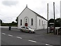
St Oliver Plunkett Chapel, Dorsey
This is a chapel in the parish known as Lower Creggan. The parish church is at Cullyhanna.
Image: © Eric Jones
Taken: 2 Sep 2014
0.03 miles
3
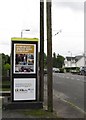
NI Department of Culture, Arts and Leisure ad promoting the Irish Language at Dorsey
http://www.dcalni.gov.uk/february_14_newsletter__english_.pdf
Image: © Eric Jones
Taken: 2 Sep 2014
0.04 miles
4
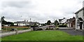
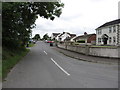
The village of Dorsey, South Armagh
The image was taken from Garvey's Road with the camera pointing northwards along Carrickrovaddy Road.
Image: © Eric Jones
Taken: 2 Sep 2014
0.06 miles
5
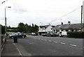
The southern end of Carrickrovaddy Road from its junction with Garvey's Road
The image is taken from the centre of the village of Dorsey, a few miles south of Cullyhanna.
Image: © Eric Jones
Taken: 2 Sep 2014
0.06 miles
6
View south along Carrickrovady Road, Dorsey
Image: © Eric Jones
Taken: 2 Sep 2014
0.08 miles
8
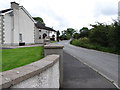
Garvey's Road at its junction with Carrickrovaddy Road at Dorsey
Image: © Eric Jones
Taken: 2 Sep 2014
0.10 miles
9
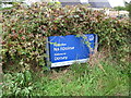
Village name sign at the junction of Garvey's Road and Carrickrovaddy Road, Dorsey
Na nDoirse means "the gateways" and refers to the gateways in the Dorsey Iron Age embankment between Dorsey and Silverbridge.
Image
Image: © Eric Jones
Taken: 2 Sep 2014
0.11 miles
10
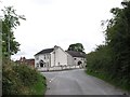
Waste Water Plant on Garvey's Road, Dorsey
Image: © Eric Jones
Taken: 2 Sep 2014
0.14 miles