IMAGES TAKEN NEAR TO
Drumalt Road, NEWRY, BT35 0QB
Introduction
This page details the photographs taken nearby to Drumalt Road, BT35 0QB by members of the Geograph project.
The Geograph project started in 2005 with the aim of publishing, organising and preserving representative images for every square kilometre of Great Britain, Ireland and the Isle of Man.

There are currently over 7.5m images from over14,400 individuals and you can help contribute to the project by visiting https://www.geograph.org.uk
Image Map
Images are licensed for reuse under creativecommons.org/licenses/by-sa/2.0
Notes
- Clicking on the map will re-center to the selected point.
- The higher the marker number, the further away the image location is from the centre of the postcode.
Image Listing (14 Images Found)
Images are licensed for reuse under creativecommons.org/licenses/by-sa/2.0
Image
Details
Distance
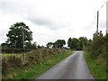
1
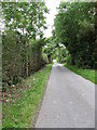
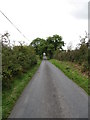
View NNW along a tree-lined section of Drumalt Road
This is just south of the junction with Dorsy Road.
Image: © Eric Jones
Taken: 2 Sep 2014
0.10 miles
2
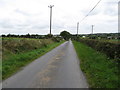
Drumalt Road south of the trunoff for Dorsey village
Image: © Eric Jones
Taken: 2 Sep 2014
0.11 miles
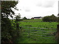
3
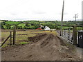
Land clearance east of the Drumalt Road
A digger is being used to remove large boulders from the boulder clay of the drumlin.
Image: © Eric Jones
Taken: 2 Sep 2014
0.12 miles
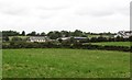
4
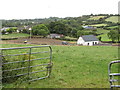
Traditional homestead cottages in the Ummeracam Valley
The image was taken from the Drumalt Road
Image: © Eric Jones
Taken: 2 Sep 2014
0.13 miles
5
View SSE along Drumalt Road from near the junction with Dorsy Road
Image: © Eric Jones
Taken: 2 Sep 2014
0.15 miles
6

Drumlins in the Ummercam Valley
The image was taken from Drumalt Road.
Image: © Eric Jones
Taken: 2 Sep 2014
0.15 miles
7
Farmhouse and buildings on the Dorsy Road
This image was taken from the Drumalt Road.
Image: © Eric Jones
Taken: 2 Sep 2014
0.18 miles
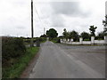
10
Drumalt Road approaching its junction with Dorsy Road
Image: © Eric Jones
Taken: 2 Sep 2014
0.22 miles