IMAGES TAKEN NEAR TO
Dundalk Road, NEWRY, BT35 0PL

Introduction

This page details the photographs taken nearby to Dundalk Road, BT35 0PL by members of the Geograph project.

The Geograph project started in 2005 with the aim of publishing, organising and preserving representative images for every square kilometre of Great Britain, Ireland and the Isle of Man.

There are currently over 7.5m images from over14,400 individuals and you can help contribute to the project by visiting https://www.geograph.org.uk

Image Map


Images are licensed for reuse under creativecommons.org/licenses/by-sa/2.0
Notes
  • Clicking on the map will re-center to the selected point.
  • The higher the marker number, the further away the image location is from the centre of the postcode.

Image Listing (10 Images Found)

Images are licensed for reuse under creativecommons.org/licenses/by-sa/2.0
Image
Details
Distance
1
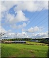
Rural settlement in the Tullyvallen Valley
The image was taken from the Coach Road.
Image: © Eric Jones Taken: 8 Aug 2019
0.03 miles
2
Boarded up old stone built cottage on the Coach Road
Image: © Eric Jones Taken: 8 Aug 2019
0.07 miles
3
The southern section of the Coach Road before it descends to join the A29
The Coach Road is older than the A29 and was the original road towards Dundalk from Newtownhamiliton. It was constructed along the summit of a drumlin so as to avoid the then wetlands of the valley floor.
Image: © Eric Jones Taken: 8 Aug 2019
0.10 miles
4
The North-South Interconnector power lines heading for Newtownhamilton
The image was taken from the southern section of the Coach Road.
Image: © Eric Jones Taken: 8 Aug 2019
0.12 miles
5
North-South Interconnector running parallel with the Coach Road
Image: © Eric Jones Taken: 8 Aug 2019
0.14 miles
6
The North-South Interconnector power lines approaching the Coach Road
Image: © Eric Jones Taken: 8 Aug 2019
0.16 miles
7
The Coach Road descending to join the A29 at the Cullyhanna Road cross roads
Image: © Eric Jones Taken: 8 Aug 2019
0.19 miles
8
The Cullyhanna Road junction on the A29 (Dundalk Road)
The image was taken from the entrance of the minor Coach Road.
Image: © Eric Jones Taken: 8 Aug 2019
0.21 miles
9
View West across the Tullyvallen Valley
The image, taken from the Coach Road, shows a drumlin landscape typical of the South Armagh area. The road in the foreground is the A29 (Dundalk Road).
Image: © Eric Jones Taken: 8 Aug 2019
0.23 miles
10
Abandoned Church
At the corner of Cullyhanna Road and Dundalk Road, A29. Story I was told that sometime in the 19th century this Protestant congregation - possibly Presbyterian - left this location and moved to Newtownhamilton because attendance had fallen. They took the roof of the church building with them.
Image: © T Michael Weddle Taken: 31 Oct 2008
0.23 miles