1
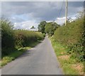
The junction of Kiltybane and Mullaghduff Road, Mullaghduff TD
The Kiltybane Road veers to the left to reach the Mullaghduff Bridge border crossing within 500m. The Mullaghduff Road also named after the Townland extends Northwards in the direction of the A25. The farms in the background are both in Co Monaghan in the Irish Republic. The condition of the road indicates that this is dairy country.
Image: © Eric Jones
Taken: 28 Aug 2019
0.08 miles
2
Modern house at the junction of Kiltybane Road and Mullaghduff Road
The drumlins in the background are in the Irish Republic. The image was taken from the Kiltybane Road.
Image: © Eric Jones
Taken: 28 Aug 2019
0.09 miles
3
Farm house and outbuildings on the south side of the Kiltybane Road
Image: © Eric Jones
Taken: 28 Aug 2019
0.10 miles
4
Pasture land and hay fields in the County Waters valley
These fields are bounded on one side by the river and on the other by the Mullaghduff Road.
Image: © Eric Jones
Taken: 28 Aug 2019
0.12 miles
5
View East along Kiltybane Road, South Armagh
The road runs parallel with the Border.
Image: © Eric Jones
Taken: 28 Aug 2019
0.13 miles
6
Harvested drumlin hay field on the Kiltybane Road
The South Armagh/East Monaghan border country is primarily dairy country. Hay is the main crop.
Image: © Eric Jones
Taken: 28 Aug 2019
0.14 miles
7
Harvested hay field between Mullaghduff Road and the County Water river
The County Water forms the border between the UK and the Republic of Ireland. The drumlins in the background are in the Republic's Co Monaghan.
Image: © Eric Jones
Taken: 28 Aug 2019
0.15 miles
8
Pasture land and harvested hay fields between the Kiltybane Road and the County Waters river
The drumlins beyond the river are in the Irish Republic.
Image: © Eric Jones
Taken: 28 Aug 2019
0.15 miles
9
Kiltybane Road ascending north-westwards towards the Border
Image: © Eric Jones
Taken: 28 Aug 2019
0.16 miles
10
The Armagh/Monaghan Border Country
The road - Kitybane Road is in South Armagh and the farm buildings are in the Republic. The border here is marked by the meandering County Water river.
Image: © Eric Jones
Taken: 28 Aug 2019
0.17 miles


