IMAGES TAKEN NEAR TO
Lisleitrim Road, NEWRY, BT35 0JU
Introduction
This page details the photographs taken nearby to Lisleitrim Road, BT35 0JU by members of the Geograph project.
The Geograph project started in 2005 with the aim of publishing, organising and preserving representative images for every square kilometre of Great Britain, Ireland and the Isle of Man.

There are currently over 7.5m images from over14,400 individuals and you can help contribute to the project by visiting https://www.geograph.org.uk
Image Map
Images are licensed for reuse under creativecommons.org/licenses/by-sa/2.0
Notes
- Clicking on the map will re-center to the selected point.
- The higher the marker number, the further away the image location is from the centre of the postcode.
Image Listing (8 Images Found)
Images are licensed for reuse under creativecommons.org/licenses/by-sa/2.0
Image
Details
Distance
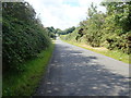
1
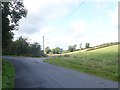
The Bog Road junction on the Lisleitrim Road
The junction is in the Townland of Sheetrim.
Image: © Eric Jones
Taken: 28 Aug 2019
0.07 miles
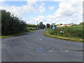
2
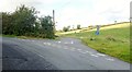
The Bog Road junction on the Lisleitrim Road West of Cullyhanna
This junction lies in the shadow of the Lisleitrim Hill Fort.
Image: © Eric Jones
Taken: 28 Aug 2019
0.07 miles
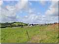
3
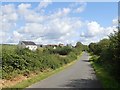
Settlement on the North side of Lisleitrim Road
These houses are located a little to the West of the Bog Road junction.
Image: © Eric Jones
Taken: 28 Aug 2019
0.12 miles
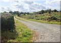
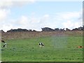
6
Rough pasture between Sheetrim Road and the Bog Road
The rounded hill on the left is topped by the Lisleitrim Fort.
Image: © Eric Jones
Taken: 28 Aug 2019
0.18 miles
7
Rath on the summit of a drumlin between Bog Road and Cargie Road
Unfortunately, the Rath was badly damaged in the 1980s when the platform structure was levelled.
https://apps.communities-ni.gov.uk/NISMR-PUBLIC/docs/ARM/ARM_027/ARM_027_005/Public/SM7-ARM-027-005.pdf
Image: © Eric Jones
Taken: 28 Aug 2019
0.21 miles
8
The Lisleitrim Junction on the Sheetrim Cross Roads
The camera points North-northwest.
Image: © Eric Jones
Taken: 28 Aug 2019
0.24 miles