IMAGES TAKEN NEAR TO
Aghincurk Road, NEWRY, BT35 0BB
Introduction
This page details the photographs taken nearby to Aghincurk Road, BT35 0BB by members of the Geograph project.
The Geograph project started in 2005 with the aim of publishing, organising and preserving representative images for every square kilometre of Great Britain, Ireland and the Isle of Man.

There are currently over 7.5m images from over14,400 individuals and you can help contribute to the project by visiting https://www.geograph.org.uk
Image Map
Images are licensed for reuse under creativecommons.org/licenses/by-sa/2.0
Notes
- Clicking on the map will re-center to the selected point.
- The higher the marker number, the further away the image location is from the centre of the postcode.
Image Listing (20 Images Found)
Images are licensed for reuse under creativecommons.org/licenses/by-sa/2.0
Image
Details
Distance
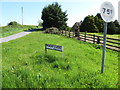
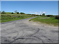
1
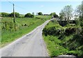
View north-eastward along the westernmost section of Aghincurk Road
Image: © Eric Jones
Taken: 3 Jun 2016
0.01 miles
2
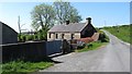
Former farmhouse adopted for farm storage purposes
This is located on Aghincurk Road.
Image: © Eric Jones
Taken: 3 Jun 2016
0.01 miles
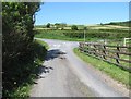
3
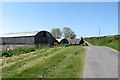
Farm buildings at the western end of Aghincurk Road
Image: © Eric Jones
Taken: 3 Jun 2016
0.01 miles
4
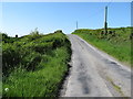
Aghincurk Road ascending towards its junction with the Cladymillstown Road
Image: © Eric Jones
Taken: 3 Jun 2016
0.04 miles
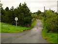
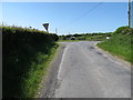
5
Weight restriction sign at the entrance to Mcrory's Road
The road on the right is Aghincurk Road,
Image: © Eric Jones
Taken: 3 Jun 2016
0.04 miles
6
Mcrorys's Road at its junction with Aghincurk Road
Image: © Eric Jones
Taken: 3 Jun 2016
0.04 miles
7
McRory's Road, Knockavannon
Off main Newtownhamilton to Markethill road.
Image: © Dean Molyneaux
Taken: 14 Aug 2009
0.05 miles
8
Entrance into Aghincurk Road from the B78
Image: © Eric Jones
Taken: 3 Jun 2016
0.06 miles
9
The B78 (Cladymilltown Road) north of the Aghincurk Road junction
Image: © Eric Jones
Taken: 3 Jun 2016
0.06 miles
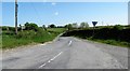
10
Aghincurk Road at its junction with the B78 (Cladymilltown Road)
Image: © Eric Jones
Taken: 3 Jun 2016
0.07 miles