IMAGES TAKEN NEAR TO
Banbridge Road, NEWRY, BT34 5PQ
Introduction
This page details the photographs taken nearby to Banbridge Road, BT34 5PQ by members of the Geograph project.
The Geograph project started in 2005 with the aim of publishing, organising and preserving representative images for every square kilometre of Great Britain, Ireland and the Isle of Man.

There are currently over 7.5m images from over14,400 individuals and you can help contribute to the project by visiting https://www.geograph.org.uk
Image Map
Images are licensed for reuse under creativecommons.org/licenses/by-sa/2.0
Notes
- Clicking on the map will re-center to the selected point.
- The higher the marker number, the further away the image location is from the centre of the postcode.
Image Listing (4 Images Found)
Images are licensed for reuse under creativecommons.org/licenses/by-sa/2.0
Image
Details
Distance
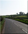
3
Banbridge Road B10
At the junction of Church Hill
Image: © HENRY CLARK
Taken: 25 Jun 2009
0.19 miles
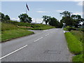
4
Keeping the Union flag flying on Church Hill, Rathfriland
The image was taken on the B10 (Banbridge Road). At the eastern end of Church Hill is Drumballyroney Church associated with Patrick Bronte Image
Image: © Eric Jones
Taken: 28 Mar 2012
0.20 miles