IMAGES TAKEN NEAR TO
Moneyscalp Road, NEWRY, BT34 5JZ
Introduction
This page details the photographs taken nearby to Moneyscalp Road, BT34 5JZ by members of the Geograph project.
The Geograph project started in 2005 with the aim of publishing, organising and preserving representative images for every square kilometre of Great Britain, Ireland and the Isle of Man.

There are currently over 7.5m images from over14,400 individuals and you can help contribute to the project by visiting https://www.geograph.org.uk
Image Map
Images are licensed for reuse under creativecommons.org/licenses/by-sa/2.0
Notes
- Clicking on the map will re-center to the selected point.
- The higher the marker number, the further away the image location is from the centre of the postcode.
Image Listing (2 Images Found)
Images are licensed for reuse under creativecommons.org/licenses/by-sa/2.0
Image
Details
Distance
1
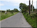
Moneyscalp Road from the junction with Planting Road
This road runs south-eastwards to join the B180.
Image: © Eric Jones
Taken: 2 Jul 2011
0.16 miles
2
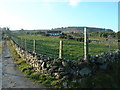
Muine Scailpe - Moneyscalp
Muine Scailpe - thicket of the fissure
Image: © Kevin O'Kane
Taken: 24 Dec 2005
0.20 miles