IMAGES TAKEN NEAR TO
Bannfield Road, NEWRY, BT34 5HG

Introduction

This page details the photographs taken nearby to Bannfield Road, BT34 5HG by members of the Geograph project.

The Geograph project started in 2005 with the aim of publishing, organising and preserving representative images for every square kilometre of Great Britain, Ireland and the Isle of Man.

There are currently over 7.5m images from over14,400 individuals and you can help contribute to the project by visiting https://www.geograph.org.uk

Image Map


Images are licensed for reuse under creativecommons.org/licenses/by-sa/2.0
Notes
  • Clicking on the map will re-center to the selected point.
  • The higher the marker number, the further away the image location is from the centre of the postcode.

Image Listing (19 Images Found)

Images are licensed for reuse under creativecommons.org/licenses/by-sa/2.0
Image
Details
Distance
1
Laurelhill, Clonduff
A private lane runs along the drumlin ridge linking a number of farms to the Bannfield Road.
Image: © Eric Jones Taken: 9 Oct 2018
0.01 miles
2
Ruined homestead south of the Bannfield Road
Image: © Eric Jones Taken: 9 Oct 2018
0.08 miles
3
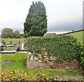
Graveyard at Clonduff Presbyterian Church, Ballynagappoge
The graveyard is set on the east side of the church. The stone structure on the extreme right is a burial vault.
Image: © Eric Jones Taken: 9 Oct 2018
0.09 miles
4
Burial vault at Clonduff Presbyterian Church, Ballynagappoge
These barrel shaped vaults are very common in Northern Irish cemeteries. They date back to the Victorian era.
Image: © Eric Jones Taken: 9 Oct 2018
0.09 miles
5
Approaching Clonduff Presbyterian Church from the east along Bannfield Road
Image: © Eric Jones Taken: 9 Oct 2018
0.10 miles
6
Tree-lined section of Bannfield Road
Image: © Eric Jones Taken: 9 Oct 2018
0.11 miles
7
Clonduff Presbyterian Church, Bannfield Road, Ballynagappoge
This rural church is situated north of the A25. The church was built between 1840 and 1859 and shares its minister with the Hilltown Presbyterian Church.
Image: © Eric Jones Taken: 9 Oct 2018
0.11 miles
8
Agricultural traffic on the Bannfield Road
The tractor is passing the Clonduff Presbyterian Church most of whose members come from an agricultural background.
Image: © Eric Jones Taken: 9 Oct 2018
0.11 miles
9
Clonduff Presbyterian Church, Bannfield Road, Ballynagappoge
The building beyond is the Clonduff Presbyterian Hall.
Image: © Eric Jones Taken: 9 Oct 2018
0.12 miles
10
Ballynagappoge Flax Mill
This disused steam powered flax mill is located on Bannfield Road.
Image: © Eric Jones Taken: 9 Oct 2018
0.12 miles