
IMAGES TAKEN NEAR TO
Drumnascamph Bungalows, NEWRY, BT34 5EH
Introduction
This page details the photographs taken nearby to Drumnascamph Bungalows, BT34 5EH by members of the Geograph project.
The Geograph project started in 2005 with the aim of publishing, organising and preserving representative images for every square kilometre of Great Britain, Ireland and the Isle of Man.

There are currently over 7.5m images from over14,400 individuals and you can help contribute to the project by visiting https://www.geograph.org.uk
Image Map
Images are licensed for reuse under creativecommons.org/licenses/by-sa/2.0
Notes
- Clicking on the map will re-center to the selected point.
- The higher the marker number, the further away the image location is from the centre of the postcode.
Image Listing (20 Images Found)
Images are licensed for reuse under creativecommons.org/licenses/by-sa/2.0
Image
Details
Distance
1
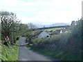
Small housing estate on the Cavan Road at Drumnascamph
This estate faces the disused Drumnascamph Flax Mill,
Image: © Eric Jones
Taken: 9 Oct 2018
0.01 miles
2
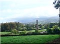
The disused Drumnascamph Flax Mill at Cavan, Rathfriland
This was one of five flax mills in this area. The Mourne Mountains form the background.
Image: © Eric Jones
Taken: 9 Oct 2018
0.03 miles
3
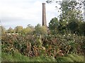
Chimney of derelict flax mill at Cavan TD, Rathfriland
Flax mills were common features in Ulster until the mid-20C. Nowadays little or no flax is commercially grown in the province.
http://eprints.maynoothuniversity.ie/5589/1/WJS_flax.pdf
Image: © Eric Jones
Taken: 9 Oct 2018
0.04 miles
4
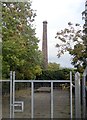
Main gate and chimney of the disused Drumnascamph Flax Mill
Image: © Eric Jones
Taken: 9 Oct 2018
0.04 miles
5
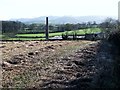
The chimney of a disused flaxmill viewed across cropland on the Cavan Road
Flax mills were common features in Co Down until fairly recently. Nowadays little flax is grown in Ulster.
Image: © Eric Jones
Taken: 5 Nov 2011
0.05 miles
6
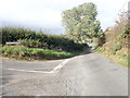
The Drumnascamph Road junction on the Cavan Road, near Rathfriland
Image: © Eric Jones
Taken: 9 Oct 2018
0.05 miles
7
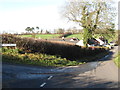
The junction of Drumnascamph and Cavan Roads
Image: © Eric Jones
Taken: 5 Nov 2011
0.06 miles
8
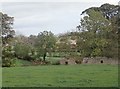
Ruined mill building on the east side of the Cavan Road
Image: © Eric Jones
Taken: 9 Oct 2018
0.12 miles
9
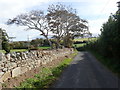
Cavan Road descending eastwards beyond the Drumnascamph Road junction
A recently demolished lodge cottage used to stand beneath the trees.
Image: © Eric Jones
Taken: 9 Oct 2018
0.13 miles
10
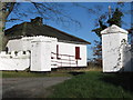
A farm gatehouse on the Cavan Road
This former lodge now appears to be disused. Such farm lodges are fairly common in Ireland.
Image: © Eric Jones
Taken: 5 Nov 2011
0.13 miles