IMAGES TAKEN NEAR TO
Longstone Hill, NEWRY, BT34 5BT
Introduction
This page details the photographs taken nearby to Longstone Hill, BT34 5BT by members of the Geograph project.
The Geograph project started in 2005 with the aim of publishing, organising and preserving representative images for every square kilometre of Great Britain, Ireland and the Isle of Man.

There are currently over 7.5m images from over14,400 individuals and you can help contribute to the project by visiting https://www.geograph.org.uk
Image Map
Images are licensed for reuse under creativecommons.org/licenses/by-sa/2.0
Notes
- Clicking on the map will re-center to the selected point.
- The higher the marker number, the further away the image location is from the centre of the postcode.
Image Listing (10 Images Found)
Images are licensed for reuse under creativecommons.org/licenses/by-sa/2.0
Image
Details
Distance
1
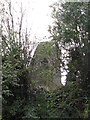
The Longstone
This standing stone on the summit of a drumlin gives its name to the passing road - Longstone Hill.
Image: © Eric Jones
Taken: 27 Oct 2011
0.05 miles
3
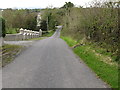
View west down Longstone Hill
The hill descends down to the chapel village of Barnmean and on to the A25.
Image: © Eric Jones
Taken: 27 Oct 2011
0.16 miles
4
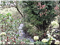
Entrenched stream on the north side of Longstone Hill road
Image: © Eric Jones
Taken: 27 Oct 2011
0.17 miles
5
One of the headwaters of the Clanrye River at Barnmeen
Image: © Eric Jones
Taken: 27 Oct 2011
0.17 miles
6
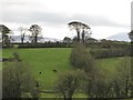
Hollow wetland east of Barnmeen's St Colman's Chapel
Longstone Hill forms the background.
Image: © Eric Jones
Taken: 14 Mar 2017
0.18 miles
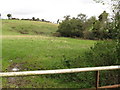
7
View south across the valley of the headwaters of the Clanrye River
Image: © Eric Jones
Taken: 27 Oct 2011
0.20 miles
8
View north along the southern most section of Sugartown Road
Image: © Eric Jones
Taken: 27 Oct 2011
0.22 miles
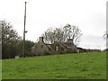
9
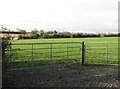
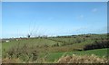
View across farmland to a farm off Longstone Hill
This image was taken from the Gransha Road.
Image: © Eric Jones
Taken: 27 Oct 2011
0.24 miles
10
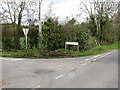
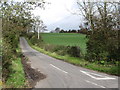
The southern end of Sugartown Road
Here, Sugartown Road joins the Lonstone Hill Road.
Image: © Eric Jones
Taken: 27 Oct 2011
0.25 miles