IMAGES TAKEN NEAR TO
Leeward Cove, NEWRY, BT34 4US
Introduction
This page details the photographs taken nearby to Leeward Cove, BT34 4US by members of the Geograph project.
The Geograph project started in 2005 with the aim of publishing, organising and preserving representative images for every square kilometre of Great Britain, Ireland and the Isle of Man.

There are currently over 7.5m images from over14,400 individuals and you can help contribute to the project by visiting https://www.geograph.org.uk
Image Map
Images are licensed for reuse under creativecommons.org/licenses/by-sa/2.0
Notes
- Clicking on the map will re-center to the selected point.
- The higher the marker number, the further away the image location is from the centre of the postcode.
Image Listing (59 Images Found)
Images are licensed for reuse under creativecommons.org/licenses/by-sa/2.0
Image
Details
Distance
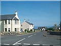
1
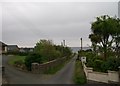
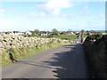
View seawards along Wreck Road, Annalong
Image: © Eric Jones
Taken: 14 May 2014
0.03 miles
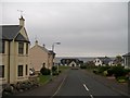
6
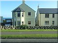
Apartments at Leeward Court, Annalong
The image was taken from the A2.
Image: © Eric Jones
Taken: 16 Oct 2019
0.06 miles
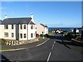
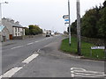
8
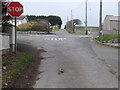
The junction of the Wreck Road with the A2 Kilkeel Road
Wreck Road continues northwards of the junction as Grove Road.
Image: © Eric Jones
Taken: 16 Mar 2011
0.06 miles
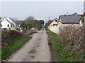
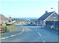
9
View south-eastwards along Grove Road in the direction of the coast
Image: © Eric Jones
Taken: 3 Nov 2012
0.06 miles
10
The Kilkeel Road (A2) eastwards of Wreck Road
Wreck Road is located at the western end of the village of Annalong.
Image: © Eric Jones
Taken: 16 Mar 2011
0.07 miles