IMAGES TAKEN NEAR TO
Benagh Road, NEWRY, BT34 4SG
Introduction
This page details the photographs taken nearby to Benagh Road, BT34 4SG by members of the Geograph project.
The Geograph project started in 2005 with the aim of publishing, organising and preserving representative images for every square kilometre of Great Britain, Ireland and the Isle of Man.

There are currently over 7.5m images from over14,400 individuals and you can help contribute to the project by visiting https://www.geograph.org.uk
Image Map
Images are licensed for reuse under creativecommons.org/licenses/by-sa/2.0
Notes
- Clicking on the map will re-center to the selected point.
- The higher the marker number, the further away the image location is from the centre of the postcode.
Image Listing (9 Images Found)
Images are licensed for reuse under creativecommons.org/licenses/by-sa/2.0
Image
Details
Distance
1
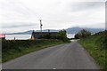
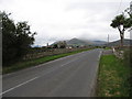
Corcreaghan Road approaching its junction with Benagh Road
Carlingford Lough and the Cooley Mountains form the background.
Image: © Eric Jones
Taken: 19 Oct 2012
0.02 miles
2
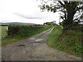
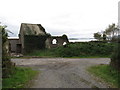
Private farm access lane
This lane provides access to a group of farms and houses in the area between Corcreaghan and Millbay Roads
Image: © Eric Jones
Taken: 19 Oct 2012
0.03 miles
3
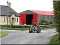
Bringing home the potato harvest
This image was taken on the Benagh Road at its junction with the Corcreaghan Road.
Image: © Eric Jones
Taken: 19 Oct 2012
0.04 miles
4
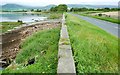
The Loughshore near Greencastle
Parts of the Co Down shore of Carlingford Lough include several small bays. This one is to the north of Greencastle. The Benagh Road is on the right.
Image: © Albert Bridge
Taken: 29 Aug 2008
0.08 miles
6
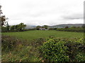
Farmland on the north side of Corcreaghan Road
Image: © Eric Jones
Taken: 19 Oct 2012
0.17 miles
8

Mourne Mountains Range
Panoramic view of the Mourne Mountains, as viewed from a carpark at Greenore, Eire.
Image: © Wilson Adams
Taken: 22 Jan 2004
0.21 miles