1
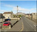
View northwards along Moneydarragh Road, Annalong
Slieve Binnian can be seen in the background.
Image: © Eric Jones
Taken: 3 Nov 2012
0.05 miles
2
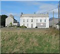
Side view of the former derelict Coastguard Station at Annalong
Image: © Eric Jones
Taken: 3 Nov 2012
0.08 miles
3
The former rocket tower and pigeon loft at the disused Annalong Coastal Station
This is the only rocket tower to have survived on the Island of Ireland. Remedial work is being carried out on the building.
Image: © Eric Jones
Taken: 3 Nov 2012
0.08 miles
4
The former Annalong Coastguard Station
This is one of a number of large stations which have been decommissioned by the Coastguard Service. The site has planning permission for a mews development. The church tower like buildings on the left is a former Coastguard rocket tower cum pigeon loft - the only one still standing on the island of Ireland.
Image
Image: © Eric Jones
Taken: 16 Mar 2011
0.12 miles
5
The Old Coastguard Station at Annalong
This is one of a number of large stations which have been decommissioned by the Coastguard Service. The site has planning permission for a mews development. The buildings on the site current include a rocket tower cum pigeon loft - the only one still standing on the isle of Ireland.
http://www.hazelbankdevelopments.com/
Image: © Eric Jones
Taken: 19 Mar 2011
0.13 miles
6
The derelict former Coastguard Station at Annalong
This is one of a number of large stations in Co Down which over the years have been decommissioned by the Coastguard Service. The site has planning permission for a mews development. The buildings on the site current include a rocket tower cum pigeon loft - the only one still standing on the isle of Ireland.
Image: © Eric Jones
Taken: 3 Nov 2012
0.14 miles
7
Moneydarragh Road, Annalong, at the junction with the A2
This lead north to the Longstone Road beyond which it assumes the name Oldtown Road
Image: © Eric Jones
Taken: 19 Mar 2011
0.14 miles
8
Farmhouse on the western outskirts of Annalong
Image: © Eric Jones
Taken: 12 Jul 2012
0.15 miles
9
Refurbished house on Kilkeel Road
This delightfully refurbished house had previously been derelict. It faces Kilhorne CoI Church across the A2.
Image: © Eric Jones
Taken: 3 Nov 2012
0.15 miles
10
For Sale sign on the site of the former Coastguard Station at Annalong
Planning permission has been granted for the erection of twenty houses on this site.
Image: © Eric Jones
Taken: 3 Nov 2012
0.15 miles


