IMAGES TAKEN NEAR TO
Carneyhough Court, NEWRY, BT34 2TW
Introduction
This page details the photographs taken nearby to Carneyhough Court, BT34 2TW by members of the Geograph project.
The Geograph project started in 2005 with the aim of publishing, organising and preserving representative images for every square kilometre of Great Britain, Ireland and the Isle of Man.

There are currently over 7.5m images from over14,400 individuals and you can help contribute to the project by visiting https://www.geograph.org.uk
Image Map
Images are licensed for reuse under creativecommons.org/licenses/by-sa/2.0
Notes
- Clicking on the map will re-center to the selected point.
- The higher the marker number, the further away the image location is from the centre of the postcode.
Image Listing (40 Images Found)
Images are licensed for reuse under creativecommons.org/licenses/by-sa/2.0
Image
Details
Distance
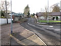
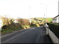
1
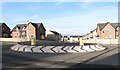
Traffic roundabout on Crieve Road
This recently constructed roundabout is located at the junction of Creive Road and Monks Hill Road. It was made necessary by the building of the Carneyhough Housing Estate (seen in the background) which has led to a substantial increase in road traffic.
Image: © Eric Jones
Taken: 30 Nov 2016
0.07 miles
2
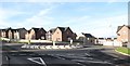
The Crieve Road Roundabout
This recently constructed roundabout is located at the junction of Creive Road and Monks Hill Road. It was made necessary by the building of the Carneyhough Housing Estate (seen in the background) which has led to a substantial increase in road traffic.
Image: © Eric Jones
Taken: 30 Nov 2016
0.07 miles
3
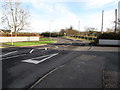
Crieve Road west of the Roundabout
Crieve Road is a sub-urban residential road running between the A25 (Rathfriland Road) and the B8 (Hilltown Road).
Image: © Eric Jones
Taken: 30 Nov 2016
0.08 miles
4
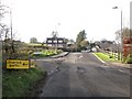
The Fort Hill Road junction on the Crieve Road
This is located just east of the Crieve Road Roundabout.
Image: © Eric Jones
Taken: 30 Nov 2016
0.09 miles
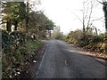
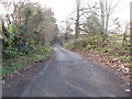
5
The eastern end of Monks Hill Road
The image was taken from near the new Crieve Road roundabout
Image: © Eric Jones
Taken: 30 Nov 2016
0.09 miles
6
View west along the eastern end of Monks Hill Road
Image: © Eric Jones
Taken: 30 Nov 2016
0.12 miles
8
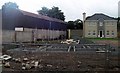
New housing estate under construction on the Hilltown Road, Newry
Image: © Eric Jones
Taken: 17 Jul 2010
0.13 miles
9
Crieve Road descending to join the B8 (Hilltown Road)
Image: © Eric Jones
Taken: 30 Nov 2016
0.14 miles
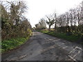
10
Monks Hill Road
The road runs through an area of wetland and dry heath on the urban fringe of Newry.
Image: © Eric Jones
Taken: 30 Nov 2016
0.15 miles