IMAGES TAKEN NEAR TO
Clontafleece Road, NEWRY, BT34 2SB
Introduction
This page details the photographs taken nearby to Clontafleece Road, BT34 2SB by members of the Geograph project.
The Geograph project started in 2005 with the aim of publishing, organising and preserving representative images for every square kilometre of Great Britain, Ireland and the Isle of Man.

There are currently over 7.5m images from over14,400 individuals and you can help contribute to the project by visiting https://www.geograph.org.uk
Image Map
Images are licensed for reuse under creativecommons.org/licenses/by-sa/2.0
Notes
- Clicking on the map will re-center to the selected point.
- The higher the marker number, the further away the image location is from the centre of the postcode.
Image Listing (20 Images Found)
Images are licensed for reuse under creativecommons.org/licenses/by-sa/2.0
Image
Details
Distance
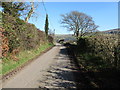
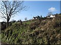
3
View south-westwards along Yellow Road
The "No National Park" poster is part of the farming lobby's campaign against a proposal to set up a Mourne National Park. Northern Ireland has no National Parks.
http://www.belfasttelegraph.co.uk/news/environment/farmers-up-in-arms-over-mournes-national-park-plan-28790015.html
Image: © Eric Jones
Taken: 19 Feb 2013
0.06 miles
4
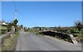
Ballyvally Bridge from the south
The bridge spans the Moygannon River. The junction with Yellow Road can be seen beyond the bridge.
Image: © Eric Jones
Taken: 19 Feb 2013
0.09 miles
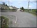
5
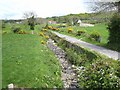
Houses on Yellow Road viewed from the Ballyvally Road
Image: © Eric Jones
Taken: 19 Feb 2013
0.09 miles
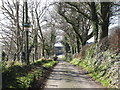
6
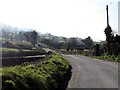
Approaching Ballyvally Bridge from the north
The bridge spans the youthful Moygannon River which enters the sea east of Warrenpoint. The junction with Coyles Hill road can be seen on the left hand side beyond the Bridge. Ballyvally is not a misprint - it has nothing to do with valleys - instead it is a corruption of the Irish name "Baile an bhealaigh" meaning townland of the gap/pass.
Image: © Eric Jones
Taken: 19 Feb 2013
0.09 miles
7
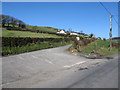
The junction of Yellow Road and the Ballyvally Road near Ballyvally Bridge
The houses are at the sharp bend on the Yellow Road.
Image: © Eric Jones
Taken: 19 Feb 2013
0.09 miles
8
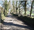
Hairpin bend on the Clontifleece Road
Where the road drops steeply down into the floor of the Moygannon Valley.
Image: © Oliver Dixon
Taken: 12 May 2007
0.09 miles
9
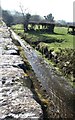
Coyleshill Road
Looking upstream along the Moygannon River from Ballyvally Bridge.
Image: © Oliver Dixon
Taken: 12 May 2007
0.11 miles
10
The Moygannon River immediately below Ballyvally Bridge
Here the stream flow parallel with Ballyvally Road.
Image: © Eric Jones
Taken: 19 Feb 2013
0.11 miles