IMAGES TAKEN NEAR TO
Ballyvally Road, NEWRY, BT34 2RY
Introduction
This page details the photographs taken nearby to Ballyvally Road, BT34 2RY by members of the Geograph project.
The Geograph project started in 2005 with the aim of publishing, organising and preserving representative images for every square kilometre of Great Britain, Ireland and the Isle of Man.

There are currently over 7.5m images from over14,400 individuals and you can help contribute to the project by visiting https://www.geograph.org.uk
Image Map
Images are licensed for reuse under creativecommons.org/licenses/by-sa/2.0
Notes
- Clicking on the map will re-center to the selected point.
- The higher the marker number, the further away the image location is from the centre of the postcode.
Image Listing (13 Images Found)
Images are licensed for reuse under creativecommons.org/licenses/by-sa/2.0
Image
Details
Distance
1
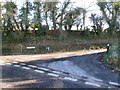
The Levallyreagh Road junction on Clonallon Road
Levallyreagh Road rubs diagonally south-eastwards in the direction of the coastal village of Rostrevor.
Image: © Eric Jones
Taken: 23 Nov 2016
0.03 miles
2
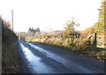
Clonallon Road between the junctions with Upper Knockbarragh Road and Levallyreagh Road
Image: © Eric Jones
Taken: 23 Nov 2016
0.05 miles
3
The Moygannon River above the Clonallon Road bridge
Image: © Eric Jones
Taken: 23 Nov 2016
0.13 miles
4
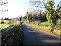
View ENE along Clonallon Road
The image was taken from the bridge over the Moygannon River.
Image: © Eric Jones
Taken: 23 Nov 2016
0.14 miles
5
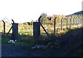
Disused covered reservoir on Upper Knockbarragh Road
Image: © Eric Jones
Taken: 23 Nov 2016
0.15 miles
6
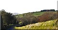
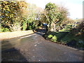
The Clonallon Road above the bridge over the Moygannon River
Image: © Eric Jones
Taken: 23 Nov 2016
0.15 miles
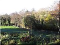
7
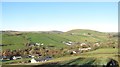
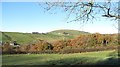
Rural settlement pattern in the Upper Moygannon Valley
This image was taken from the Upper Knockbarragh Road.
Image: © Eric Jones
Taken: 23 Nov 2016
0.15 miles
8
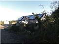
House under construction near the junction of Upper Knockbarragh Road and Clonallon Road
Image: © Eric Jones
Taken: 23 Nov 2016
0.16 miles
9
Drumlin slope shelter belt in the upper Moygannon valley
Image: © Eric Jones
Taken: 23 Nov 2016
0.16 miles
10
The junction of Upper Knockbarragh Road and Clonallon Road
Image: © Eric Jones
Taken: 23 Nov 2016
0.17 miles