IMAGES TAKEN NEAR TO
Crown Crescent, NEWRY, BT34 2LL
Introduction
This page details the photographs taken nearby to Crown Crescent, BT34 2LL by members of the Geograph project.
The Geograph project started in 2005 with the aim of publishing, organising and preserving representative images for every square kilometre of Great Britain, Ireland and the Isle of Man.

There are currently over 7.5m images from over14,400 individuals and you can help contribute to the project by visiting https://www.geograph.org.uk
Image Map
Images are licensed for reuse under creativecommons.org/licenses/by-sa/2.0
Notes
- Clicking on the map will re-center to the selected point.
- The higher the marker number, the further away the image location is from the centre of the postcode.
Image Listing (56 Images Found)
Images are licensed for reuse under creativecommons.org/licenses/by-sa/2.0
Image
Details
Distance
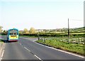
1
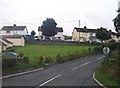
Houses at the northern end of Crieve Road
Image: © Eric Jones
Taken: 17 Jul 2010
0.02 miles
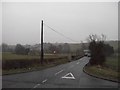
2
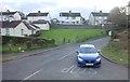
Crieve Road junction on the B8 (Hilltown Road)
Image: © Eric Jones
Taken: 29 Oct 2019
0.03 miles
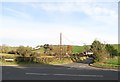
3
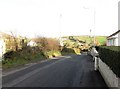
Crieve Road descending to join the B8 (Hilltown Road)
Image: © Eric Jones
Taken: 30 Nov 2016
0.04 miles
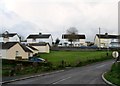
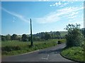
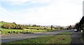
5
The Hilltown Road at the junction with Sheepstown Road
The outer suburbs of Newry can be seen in the background.
Image: © Eric Jones
Taken: 16 May 2013
0.04 miles
6
Sheeptown Road at its junction with the B8 (Hilltown Road)
Image: © Eric Jones
Taken: 30 Nov 2016
0.05 miles
7
The southern end of Sheepstown Road on a murky December morning
Image: © Eric Jones
Taken: 31 Dec 2010
0.05 miles
8
Sheeptown Road at its junction with the B8 (Hilltown Road)
Image: © Eric Jones
Taken: 6 Jun 2013
0.06 miles
9
View south-eastwards along the B8 (Hilltown Road)
This image was taken from the crossroads with Sheeptown and Crieve roads.
Image: © Eric Jones
Taken: 30 Nov 2016
0.06 miles
10
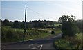
The mouth of the Sheepstown Road
This road leads north from the Hilltown Road. The bridge sign reminds drivers of the humpbacked Crown Bridge across the Clanrye River.
Image: © Eric Jones
Taken: 22 Aug 2009
0.08 miles