
IMAGES TAKEN NEAR TO
Barr Hill, NEWRY, BT34 1SY
Introduction
This page details the photographs taken nearby to Barr Hill, BT34 1SY by members of the Geograph project.
The Geograph project started in 2005 with the aim of publishing, organising and preserving representative images for every square kilometre of Great Britain, Ireland and the Isle of Man.

There are currently over 7.5m images from over14,400 individuals and you can help contribute to the project by visiting https://www.geograph.org.uk
Image Map
Images are licensed for reuse under creativecommons.org/licenses/by-sa/2.0
Notes
- Clicking on the map will re-center to the selected point.
- The higher the marker number, the further away the image location is from the centre of the postcode.
Image Listing (15 Images Found)
Images are licensed for reuse under creativecommons.org/licenses/by-sa/2.0
Image
Details
Distance
1
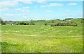
An early April crop of silage on Barr Hill
Image: © Eric Jones
Taken: 10 Apr 2019
0.04 miles
3
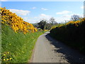
Descending East down the whin hedged Barr Hill road
Image: © Eric Jones
Taken: 10 Apr 2019
0.08 miles
4
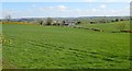
Improved grassland east of Barr Hill
This area of South Down is pastoral country with sheep, beef and dairy cattle predominating. The glacial till produce heavy soils which are not best suited to cereal and vegetable crops.The Slieve Croob range can be seen in the far distance.
Image: © Eric Jones
Taken: 10 Apr 2019
0.15 miles
5
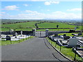
View eastwards from the main door of St Mary's Chapel, Carrickrovaddy TD
The view extends across the drumlin topography of South Down towards, in the distance, the Mourne Mountains.
Image: © Eric Jones
Taken: 10 Apr 2019
0.16 miles
6
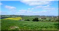
Drumlins in the Armagh/Down borderland
The image was taken from the Barr Hill road.
Image: © Eric Jones
Taken: 10 Apr 2019
0.16 miles
7
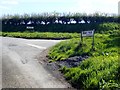
Junction at the crest of Barr Hill
Both stretches of road are known as Barr Hill. The section on the right leads past St Mary's Chapel to the village of Lurganare. The other continues east to the junction with Congary Road.
Image: © Eric Jones
Taken: 10 Apr 2019
0.18 miles
8
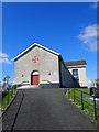
St Mary's Catholic Chapel, Carrickrovaddy
This chapel set on the summit of a drumlin serves a rural farming area.
Image: © Eric Jones
Taken: 10 Apr 2019
0.22 miles
9
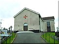
St. Mary's Church, Barr
One of three churches in the parish of Donaghmore, this church in the townland of Carrickrovaddy dates back to the Catholic Emancipation of 1829, having been built a year later in 1830. Its appearance is due to (very) extensive renovations in 1969. It was internally renovated following a fire in 1995.
There is no townland of Barr - the word meaning 'top', which suitably describes its position on Barr Hill - near the village of Lurganare.
Image: © Dean Molyneaux
Taken: 5 Apr 2010
0.22 miles
10
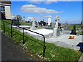
Part of the graveyard of St Mary's Catholic Chapel, Carrickrovaddy
These are family plots, a common feature in the graveyards of both communities in Northern Ireland.
Image: © Eric Jones
Taken: 10 Apr 2019
0.23 miles