
IMAGES TAKEN NEAR TO
The Mall, NEWRY, BT34 1BX
Introduction
This page details the photographs taken nearby to The Mall, BT34 1BX by members of the Geograph project.
The Geograph project started in 2005 with the aim of publishing, organising and preserving representative images for every square kilometre of Great Britain, Ireland and the Isle of Man.

There are currently over 7.5m images from over14,400 individuals and you can help contribute to the project by visiting https://www.geograph.org.uk
Image Map
Images are licensed for reuse under creativecommons.org/licenses/by-sa/2.0
Notes
- Clicking on the map will re-center to the selected point.
- The higher the marker number, the further away the image location is from the centre of the postcode.
Image Listing (643 Images Found)
Images are licensed for reuse under creativecommons.org/licenses/by-sa/2.0
Image
Details
Distance
1
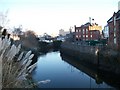
Early morning on the Clanrye River
This a view in the direction of the red brick Newry Town Hall from Needham Bridge.
Image: © Eric Jones
Taken: 20 Feb 2010
0.01 miles
2
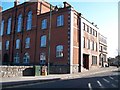
A side and rear view of Newry Town Hall
This image was taken in Kildare Street.
Image: © Eric Jones
Taken: 30 Apr 2013
0.02 miles
3
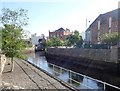
The Clanrye River above Needhams Bridge
The building in the centre of the image which spans the river is Newry Town Hall.
Image: © Eric Jones
Taken: 7 Jun 2019
0.02 miles
4
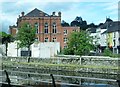
The rear of the Newry City Hall
This is the view across the Newry Canal from Merchant's Quay.
Image: © Eric Jones
Taken: 24 Jun 2016
0.02 miles
5
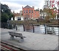
The rear of Newry City Hall from the Merchant's Quay
The Newry Canal and the Newry River are visible.
Image: © Eric Jones
Taken: 29 Oct 2019
0.02 miles
6
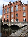
The rear of Newry Town Hall
Newry Town Hall is built on the Armagh-Down Bridge which spans the Clanrye River. At this point the boundary between Cos Armagh and Down -bisects the river. The image was taken from Kildare Street.
Image: © Eric Jones
Taken: 9 May 2016
0.02 miles
7

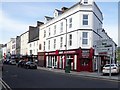
The western end of Hill Street, Newry
This used to be the city's principal shopping street. The development of the Buttercrane and Quays Shopping Centres has led to closure of many of its stores and their replacement by offices.
Image: © Eric Jones
Taken: 21 Jun 2018
0.02 miles
9
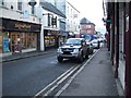
Margaret Street, Newry
This street leads westwards intersecting Hill Street at Margaret Square and leading on over the river and canal bridges to Monaghan Street.
Image: © Eric Jones
Taken: 18 Feb 2010
0.03 miles
10
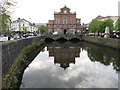
Newry Town/City Hall
Newry's Town Hall, dating from 1893, stands on a three arched bridge astride the Clanrye/Newry River. At this point the river forms the boundary between counties Armagh and Down. Nowadays the Town Hall is often referred to as the City Hall. The image was taken from Sugar Island Bridge.
Image: © Eric Jones
Taken: 9 May 2016
0.03 miles