IMAGES TAKEN NEAR TO
Roden Court, NEWCASTLE, BT33 0RE
Introduction
This page details the photographs taken nearby to Roden Court, BT33 0RE by members of the Geograph project.
The Geograph project started in 2005 with the aim of publishing, organising and preserving representative images for every square kilometre of Great Britain, Ireland and the Isle of Man.

There are currently over 7.5m images from over14,400 individuals and you can help contribute to the project by visiting https://www.geograph.org.uk
Image Map
Images are licensed for reuse under creativecommons.org/licenses/by-sa/2.0
Notes
- Clicking on the map will re-center to the selected point.
- The higher the marker number, the further away the image location is from the centre of the postcode.
Image Listing (103 Images Found)
Images are licensed for reuse under creativecommons.org/licenses/by-sa/2.0
Image
Details
Distance
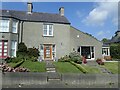
1
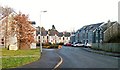
Roden Court, Bryansford
http://en.wikipedia.org/wiki/Earl_of_Roden
Image: © Eric Jones
Taken: 12 Dec 2010
0.00 miles
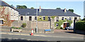
2
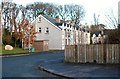
The entrance to Roden Court
This is a new development off the Burrenreagh Road. The Rodens were the Jocelyns of Tollymore, the Earldom of Roden being created in 1771.
http://en.wikipedia.org/wiki/Earl_of_Roden
Image: © Eric Jones
Taken: 12 Dec 2010
0.02 miles
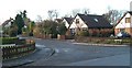
3
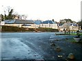
Houses in Hilltown Road, Bryansford
Bryansford was built as an estate village. This image was taken from Tollymore House's Bryansford Gate.
Image: © Eric Jones
Taken: 12 Dec 2010
0.02 miles
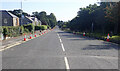
4
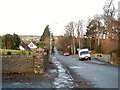
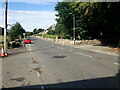
The Burrenreagh Road exiting northwards from the village of Bryansford
Image: © Eric Jones
Taken: 12 Dec 2010
0.03 miles
5
Elegant end of terrace dwelling opposite the main gates of Tollymore Park
This terrace dates back to when Bryansford was an estate village.
Image: © Eric Jones
Taken: 30 Aug 2024
0.04 miles
6
Roden Court, Bryansford
This was the core of the estate village built to accommodate the estate workers of Earl of Roden's Tollymore Park Estate.
Image: © Eric Jones
Taken: 4 Aug 2021
0.04 miles
7
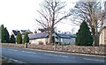
View Northeastwards along the B180 (Hilltown Road) from the vicinity of the Bryansford Gate
Image: © Eric Jones
Taken: 4 Aug 2021
0.04 miles
9
The B180 West of the Village Lane road junction
Image: © Eric Jones
Taken: 4 Aug 2021
0.05 miles
10
Modern bungalows on the western periphery of Bryansford
Image: © Eric Jones
Taken: 12 Dec 2010
0.06 miles