IMAGES TAKEN NEAR TO
Parklands, NEWCASTLE, BT33 0GS

Introduction

This page details the photographs taken nearby to Parklands, BT33 0GS by members of the Geograph project.

The Geograph project started in 2005 with the aim of publishing, organising and preserving representative images for every square kilometre of Great Britain, Ireland and the Isle of Man.

There are currently over 7.5m images from over14,400 individuals and you can help contribute to the project by visiting https://www.geograph.org.uk

Image Map


Images are licensed for reuse under creativecommons.org/licenses/by-sa/2.0
Notes
  • Clicking on the map will re-center to the selected point.
  • The higher the marker number, the further away the image location is from the centre of the postcode.

Image Listing (651 Images Found)

Images are licensed for reuse under creativecommons.org/licenses/by-sa/2.0
  • ...
Image
Details
Distance
1
Entrance arch into Donard Park
This is the main entrance to the park.
Image: © Eric Jones Taken: 20 Oct 2017
0.01 miles
2
Donard Park's entry arch
This was erected in 1951. Donard Park was donated to the people of Newcastle by the owners, the Annesley family.
Image: © Eric Jones Taken: 20 Oct 2017
0.01 miles
3
The Anchor Inn, Bryansford Road, Newcastle
Image: © Eric Jones Taken: 11 Aug 2012
0.02 miles
4
Northbound traffic in Bryansford Road
This short section of Bryansford Road is a part of the A2 (Newry to Derry/Londonderry coastal road).
Image: © Eric Jones Taken: 8 Feb 2018
0.02 miles
5
The Anchor Bar in Bryansford Road, Newcastle
Image: © Eric Jones Taken: 8 Feb 2018
0.03 miles
6
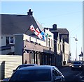
The Home Nations Flags flying above The Anchor Bar in Bryansford Road
Image: © Eric Jones Taken: 9 Feb 2018
0.03 miles
7
Houses at the southern end of Bryansford Road
This is a one way section of the A2 reserved for north bound traffic.
Image: © Eric Jones Taken: 22 Oct 2017
0.03 miles
8
PSNI Pipe Band tuning up at the Ulster Pipe Band Championships at Donard Park
Here a bagpipe tuner is being used to fine tune the bagpipes.
Image: © Eric Jones Taken: 24 Aug 2019
0.03 miles
9
Donard Forest, Newcastle (1)
Donard Forest is a state forest to the SW of Newcastle. It is a commercial forest which sees considerable recreational use. This is the entrance to Donard Park from the Bryansford Road. The park is to the right. The forest and Slieve Donard are in the background. Continue to Image
Image: © Albert Bridge Taken: 26 Dec 2007
0.03 miles
10
Mourne Mountain Rescue vehicles at Donard Park
http://mournemrt.org/
Image: © Eric Jones Taken: 9 Aug 2014
0.03 miles
  • ...