
IMAGES TAKEN NEAR TO
Merrion Avenue, NEWCASTLE, BT33 0BJ
Introduction
This page details the photographs taken nearby to Merrion Avenue, BT33 0BJ by members of the Geograph project.
The Geograph project started in 2005 with the aim of publishing, organising and preserving representative images for every square kilometre of Great Britain, Ireland and the Isle of Man.

There are currently over 7.5m images from over14,400 individuals and you can help contribute to the project by visiting https://www.geograph.org.uk
Image Map
Images are licensed for reuse under creativecommons.org/licenses/by-sa/2.0
Notes
- Clicking on the map will re-center to the selected point.
- The higher the marker number, the further away the image location is from the centre of the postcode.
Image Listing (625 Images Found)
Images are licensed for reuse under creativecommons.org/licenses/by-sa/2.0
Image
Details
Distance
1
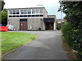
Newcastle Telephone Exchange, Co Down
Located at 25 Dundrum Road, BT33 0BG, this TE would appear to date from the early 1970s and serves Newcastle plus Bryansford and Dundrum nearby. It has the numbering ranges (02843) 72xxxx, 75xxxx, the (02843) referring to the Newcastle (Co Down) group of TEs. Incidentally, this photo was taken through the fencing that encloses the TEs in Northern Ireland.
Image: © David Hillas
Taken: 8 Aug 2016
0.05 miles
2
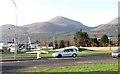
The Newcastle Gate Roundabout
This is at the junction of the Castlewellan (A50) and Dundrum (A2) roads
Image: © Eric Jones
Taken: 28 Feb 2011
0.06 miles
3
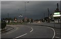
The junction of the A2 (Dundrum Road) and the A50 (Castlewellan Road) at Newcastle
Image: © Eric Jones
Taken: 19 Aug 2009
0.06 miles
4
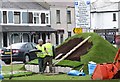
Constructing a Golf-themed flower bed on the traffic island at the junction of the Castlewellan and Belfast roads
This is in readiness for the DDF Irish Open to be held at Newcastle between 29 and 31 May, 2015.
Image: © Eric Jones
Taken: 23 May 2015
0.06 miles
5

Work in progress on the Golf-themed flower bed
Image: © Eric Jones
Taken: 23 May 2015
0.06 miles
6
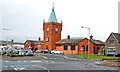
Former railway station, Newcastle
See Image The former railway station (altered but not excessively) is now a supermarket. The present bus station is on the left.
Image: © Albert Bridge
Taken: 10 Oct 2008
0.06 miles
7
School crossing patrols at the junction of the busy A50 and the A2 roads at Newcastle
Image: © Eric Jones
Taken: 11 Nov 2010
0.06 miles
8
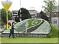
Flower bed depicting the Coat of Arms of the Newry, Mourne, and Down District Council
The gardener is putting the finishing touches to one of two newly constructed beds on the large traffic island at the junction of the Castlewellan and Belfast roads in readiness for next week's DDF 2015 Irish Open.
Image: © Eric Jones
Taken: 23 May 2015
0.06 miles
9
Routine maintenance at Newcastle's Ulsterbus Depot
Image: © Eric Jones
Taken: 7 Jun 2011
0.06 miles
10

Stormont Election 2022: SDLP poster in Railway Street, Newcastle
The SDLP is a Nationalist Party advocating the reunification of Ireland. Until 2001 it was the largest of the Nationalist parties but has since lost ground to Sinn Fein. It is led by Colum Eastwood and has two Westminster MPs.
Image: © Eric Jones
Taken: 2 May 2022
0.07 miles