
IMAGES TAKEN NEAR TO
Knock Road, BANBRIDGE, BT32 5RA
Introduction
This page details the photographs taken nearby to Knock Road, BT32 5RA by members of the Geograph project.
The Geograph project started in 2005 with the aim of publishing, organising and preserving representative images for every square kilometre of Great Britain, Ireland and the Isle of Man.

There are currently over 7.5m images from over14,400 individuals and you can help contribute to the project by visiting https://www.geograph.org.uk
Image Map
Images are licensed for reuse under creativecommons.org/licenses/by-sa/2.0
Notes
- Clicking on the map will re-center to the selected point.
- The higher the marker number, the further away the image location is from the centre of the postcode.
Image Listing (9 Images Found)
Images are licensed for reuse under creativecommons.org/licenses/by-sa/2.0
Image
Details
Distance
1
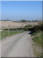
View north along Knock Road
Here the road descends down towards the valley.
Image: © Eric Jones
Taken: 28 Mar 2012
0.02 miles
3
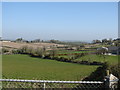
View north-northeast from the middle section of Knock Road
Image: © Eric Jones
Taken: 28 Mar 2012
0.15 miles
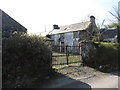
5
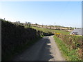
Knock Road ascending towards Knockhill Stables
Image: © Eric Jones
Taken: 28 Mar 2012
0.19 miles
6
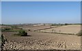
Drumlin land used for arable crops north of Knock Road
Much of the arable land around Annaclone is used for growing potatoes. Many of the farmers have contract with Tayto, the Irish potato crisp firm. Tayto has its main plant at nearby Tandragee.
http://en.wikipedia.org/wiki/Tayto_(Northern_Ireland)
Image: © Eric Jones
Taken: 28 Mar 2012
0.21 miles
7
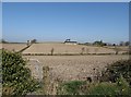
Farm buildings set on a tilled drumlin
The farm here which concentrates on arable farming is known as Fernhill House.
Image: © Eric Jones
Taken: 28 Mar 2012
0.23 miles
8
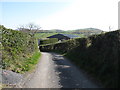
Knockhill Stables, Knock Road
These are livery stables. The twin summit of Knockiveagh can be seen in the background.
Image: © Eric Jones
Taken: 28 Mar 2012
0.25 miles
9
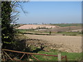
View north from Knock Road
This view shows the contrast in farming between the drumlin slopes and the inter-drumlin valleys.
Image: © Eric Jones
Taken: 28 Mar 2012
0.25 miles