
IMAGES TAKEN NEAR TO
Ashley Gardens, BANBRIDGE, BT32 4BN
Introduction
This page details the photographs taken nearby to Ashley Gardens, BT32 4BN by members of the Geograph project.
The Geograph project started in 2005 with the aim of publishing, organising and preserving representative images for every square kilometre of Great Britain, Ireland and the Isle of Man.

There are currently over 7.5m images from over14,400 individuals and you can help contribute to the project by visiting https://www.geograph.org.uk
Image Map
Images are licensed for reuse under creativecommons.org/licenses/by-sa/2.0
Notes
- Clicking on the map will re-center to the selected point.
- The higher the marker number, the further away the image location is from the centre of the postcode.
Image Listing (32 Images Found)
Images are licensed for reuse under creativecommons.org/licenses/by-sa/2.0
Image
Details
Distance
1
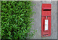
Wall box, Banbridge (1)
EIIR wall box (BT32 8), on the Castlewellan Road inward from Old Bleach Green. Image shows the box in its setting beside the Castlewellan Road.
Image: © Albert Bridge
Taken: 20 Jul 2013
0.11 miles
2
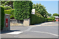
Wall box, Banbridge (2)
See Image The same box in its setting beside the Castlewellan Road (right).
Image: © Albert Bridge
Taken: 20 Jul 2013
0.11 miles
3
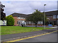
Southern Regional College, Banbridge Campus
The Southern Regional College was formed in 2007 with the amalgamation of the Upper Bann Institute (Lurgan, Portadown and Banbridge), Newry & Kilkeel Institute and Armagh Institute. They're all Further Education colleges of 'techs' as is still heard in Northern Ireland. The SRC in Banbridge, as it has been for many years, is on the Castlewellan Road. See also: Image
Image: © Dean Molyneaux
Taken: 5 Sep 2009
0.13 miles
4
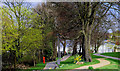
Solitude Park, Banbridge (9)
See Image The eastern side of the park – between the Bann and the Castlewellan Road. Solitude House lies beyond the trees.
Image: © Albert Bridge
Taken: 14 Apr 2010
0.14 miles
5
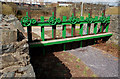
Solitude Park, Banbridge (5)
See Image A disused (and dry) sluice which, with the weir in the previous photo, was used to produce power for the factory seen in Image Continue to Image
Image: © Albert Bridge
Taken: 14 Apr 2010
0.16 miles
6
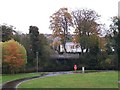
Viewing deck above the Bann in Solitude Park
Image: © Eric Jones
Taken: 6 Nov 2013
0.17 miles
7
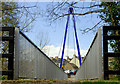
Solitude Park, Banbridge (8)
See Image The same bridge, at ground level, from the Castlewellan Road side. The Bann is out of sight, well below the bridge. Continue to Image
Image: © Albert Bridge
Taken: 14 Apr 2010
0.17 miles
8
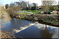
Solitude Park, Banbridge (4)
Image: © Albert Bridge
Taken: 14 Apr 2010
0.17 miles
9
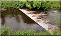
Weir, Banbridge
The Bann, looking very muddy after recent heavy rain, as it flows over the weir downstream of the footbridge Image at Solitude.
Image: © Albert Bridge
Taken: 17 Jul 2010
0.18 miles
10
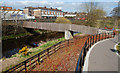
Solitude Park, Banbridge (6)
See Image There are two footbridges in the park. This one is just upstream from the sluice in the previous photo. Continue to Image
Image: © Albert Bridge
Taken: 14 Apr 2010
0.18 miles