IMAGES TAKEN NEAR TO
Osborne Gardens, BANBRIDGE, BT32 4BD

Introduction

This page details the photographs taken nearby to Osborne Gardens, BT32 4BD by members of the Geograph project.

The Geograph project started in 2005 with the aim of publishing, organising and preserving representative images for every square kilometre of Great Britain, Ireland and the Isle of Man.

There are currently over 7.5m images from over14,400 individuals and you can help contribute to the project by visiting https://www.geograph.org.uk

Image Map


Images are licensed for reuse under creativecommons.org/licenses/by-sa/2.0
Notes
  • Clicking on the map will re-center to the selected point.
  • The higher the marker number, the further away the image location is from the centre of the postcode.

Image Listing (178 Images Found)

Images are licensed for reuse under creativecommons.org/licenses/by-sa/2.0
  • ...
Image
Details
Distance
1
The Castlewellan Road, Banbridge
Road heading south from the centre of Banbridge. The sign on the left relates to the recent local council elections.
Image: © Rossographer Taken: 3 May 2019
0.01 miles
2
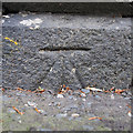
Bench Mark, Banbridge
Cut bench mark on the corner of an old building on the Castlewellan Road, Banbridge. The mark has been levelled to 55.10 metres above MSL.
Image: © Rossographer Taken: 3 May 2019
0.04 miles
3
The Bann downstream of the Solitude Park Suspension Bridge
Image: © Eric Jones Taken: 6 Nov 2013
0.08 miles
4
Banbridge's new PSNI station in Castlewellan Road
The image was taken from the old police barracks in Church Square. Banbridge is part of "E" District and is responsible for the policing of the Banbridge, Dromore, Gilford and Rathfriland areas.
Image: © Eric Jones Taken: 6 Nov 2013
0.08 miles
5
Solitude House. Castlewellan Road, Banbridge
This house and the mill next to it were originally owned by a Westmeath man called James Clibborn in the 1800's.
Image: © P Flannagan Taken: 18 Feb 2008
0.08 miles
6
Solitude Park, Banbridge (8)
See Image The same bridge, at ground level, from the Castlewellan Road side. The Bann is out of sight, well below the bridge. Continue to Image
Image: © Albert Bridge Taken: 14 Apr 2010
0.08 miles
7
Solitude Park, Banbridge (7)
See Image The second footbridge (further downstream) is this suspension bridge seen from near the Castlewellan Road. Continue to Image
Image: © Albert Bridge Taken: 14 Apr 2010
0.09 miles
8
Exercise machines in Solitude Park
The River Bann forms the background.
Image: © Eric Jones Taken: 6 Nov 2013
0.09 miles
9
Former Mill, Banbridge
This mill was originally owned by a Westmeath man called James Clibborn. It may have been a flour mill at one time though later it was used as a linen mill and was taken over by a William Walker and Thomas Dickson c. 1865. It was known as the Hazelbank Weaving Company from 1880. Part of this building contains retail shops on the main Castlewellan Road. The disused linen mill was used when "Miles Aircraft" came to Banbridge in November 1943 to manufacture complete aeroplanes. A small order was placed for the Miles Messenger M38/M11, a liaison and spotter aircraft, for use in a VIP transport role. Among VIP operators allocated personal Messengers was Field Marshal Sir Bernard Montgomery. Twenty-one were built by 200 folk from the local area.
Image: © P Flannagan Taken: 18 Feb 2008
0.10 miles
10
The River Bann upstream of Bridge Street
Image: © Eric Jones Taken: 6 Nov 2013
0.10 miles
  • ...