IMAGES TAKEN NEAR TO
Aughnacloy Road, BANBRIDGE, BT32 3RU

Introduction

This page details the photographs taken nearby to Aughnacloy Road, BT32 3RU by members of the Geograph project.

The Geograph project started in 2005 with the aim of publishing, organising and preserving representative images for every square kilometre of Great Britain, Ireland and the Isle of Man.

There are currently over 7.5m images from over14,400 individuals and you can help contribute to the project by visiting https://www.geograph.org.uk

Image Map


Images are licensed for reuse under creativecommons.org/licenses/by-sa/2.0
Notes
  • Clicking on the map will re-center to the selected point.
  • The higher the marker number, the further away the image location is from the centre of the postcode.

Image Listing (28 Images Found)

Images are licensed for reuse under creativecommons.org/licenses/by-sa/2.0
  • ...
Image
Details
Distance
1
Gate, the Corbet near Banbridge
A gate leading to fields, on drumlins, on the northern side of the Aughnacloy Road Image, near the Corbet crossroads.
Image: © Albert Bridge Taken: 23 Oct 2010
0.01 miles
2
The Aughnacloy Road near Banbridge (4)
The twisting Castlewellan – Banbridge road, approaching the Corbet crossroads, lit by the autumn sun.
Image: © Albert Bridge Taken: 23 Oct 2010
0.03 miles
3
Two hedges, the Corbet near Banbridge
Two hedges, as field boundaries on a minor drumlin, to the southwest of the Aughnacloy Road Image, past the Corbet Lough.
Image: © Albert Bridge Taken: 23 Oct 2010
0.03 miles
4
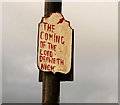
Biblical text, the Corbet near Banbridge
Attached to a telegraph pole beside the Aughnacloy Road Image, near the lane to the roads depot.
Image: © Albert Bridge Taken: 23 Oct 2010
0.07 miles
5
Trees and hedges, the Corbet near Banbridge
Trees and hedges on drumlins, on the northern side of the Aughnacloy Road Image, visible in the background in Image
Image: © Albert Bridge Taken: 23 Oct 2010
0.09 miles
6
Field and hedge, the Corbet near Banbridge
A field and hedge on the southern side of the Aughnacloy Road Image just past the Corbet Lough. The grass had a light covering of dew.
Image: © Albert Bridge Taken: 23 Oct 2010
0.13 miles
7
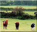
Cattle at the Corbet near Banbridge (2)
Part of a herd grazing in this field Image beside the Castlewellan – Banbridge road.
Image: © Albert Bridge Taken: 23 Oct 2010
0.14 miles
8
Letter box, the Corbet, Banbridge
Post-mounted EIIR box, on the Aughnacloy Road, on the Castlewellan side of the crossroads.
Image: © Albert Bridge Taken: 4 Mar 2011
0.14 miles
9
River Bann from Drone Hill Road
Looking up stream
Image: © HENRY CLARK Taken: 27 Dec 2008
0.16 miles
10
The River Bann at Tullyconnaught
Image: © HENRY CLARK Taken: 27 Dec 2008
0.16 miles
  • ...