
IMAGES TAKEN NEAR TO
Rathfriland Street, BANBRIDGE, BT32 3NG
Introduction
This page details the photographs taken nearby to Rathfriland Street, BT32 3NG by members of the Geograph project.
The Geograph project started in 2005 with the aim of publishing, organising and preserving representative images for every square kilometre of Great Britain, Ireland and the Isle of Man.

There are currently over 7.5m images from over14,400 individuals and you can help contribute to the project by visiting https://www.geograph.org.uk
Image Map
Images are licensed for reuse under creativecommons.org/licenses/by-sa/2.0
Notes
- Clicking on the map will re-center to the selected point.
- The higher the marker number, the further away the image location is from the centre of the postcode.
Image Listing (38 Images Found)
Images are licensed for reuse under creativecommons.org/licenses/by-sa/2.0
Image
Details
Distance
1
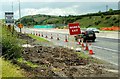
New flyover at Loughbrickland (5)
See Image The view towards Newry showing the narrow lanes now in use on the dual carriageway. Continue to Image
Image: © Albert Bridge
Taken: 6 Jul 2008
0.04 miles
2
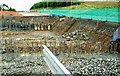
New flyover at Loughbrickland (3)
See Image The foundations for the supports for the road across the underpass are now being built partly on the course of the former north-bound carriageway. The existing dual carriageway, now with very narrow lanes, is behind the green mesh at top right. The view is towards Banbridge. Continue to Image
Image: © Albert Bridge
Taken: 6 Jul 2008
0.05 miles
3

New flyover, Loughbrickland (7)
See Image The view towards Belfast with the new flyover/underpass taking shape (left) on the line of the former north-bound carriageway. Both carriageways are now on a temporary alignment to the east. There is no public access - the photo was taken through a gap in the safety fence. Continue to Image
Image: © Albert Bridge
Taken: 31 Dec 2008
0.07 miles
4

New flyover, Loughbrickland (23)
See Image The view from the bypass, towards Loughbrickland, with the traffic heading towards Rathfriland (or south along the main road) on the underpass. This view shows the temporary restriction in width. Continue to Image
Image: © Albert Bridge
Taken: 21 Oct 2009
0.07 miles
5

New flyover, Loughbrickland (22)
See Image The view from the Loughbrickland side with the traffic heading towards Rathfriland (or south along the main road). The old underpass Image is on the right. Continue to Image
Image: © Albert Bridge
Taken: 21 Oct 2009
0.08 miles
6
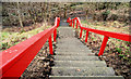
Steps, Loughbrickland
Steep steps leading from the Dublin Road to the small park at the bottom.
Image: © Albert Bridge
Taken: 27 Jan 2011
0.08 miles
7

New flyover, Loughbrickland (21)
See Image Under the flyover, looking towards Loughbrickland, with traffic passing the temporary lights. Continue to Image
Image: © Albert Bridge
Taken: 21 Oct 2009
0.08 miles
8

Banbridge Foundry access cover, Loughbrickland (2)
See Image Part of the inscription showing the maker’s name.
Image: © Albert Bridge
Taken: 19 May 2012
0.08 miles
9
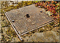
Banbridge Foundry access cover, Loughbrickland (1)
See Image Quite rare – an access cover made by the Banbridge Foundry. I have been able to trace Geoghagan’s Foundry which traded, in succession to Smyth’s, at Lenaderg in the early part of the 20th century. This cover, beside the old pump Image on the Dublin Road, looks a bit more recent. Image shows the maker’s name.
Image: © Albert Bridge
Taken: 19 May 2012
0.08 miles
10
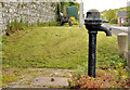
Old pump.Loughbrickland (1)
An old pump (no maker’s name visible) on the Dublin Road.
Image: © Albert Bridge
Taken: 19 May 2012
0.08 miles