1
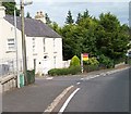
Derelict tin-roofed cottage on Station Road, Ballyward
This building was in a somewhat better shape when Google passed by in October 2008.
Image: © Eric Jones
Taken: 23 Aug 2011
0.02 miles
2
The former railway station building at Ballyward
This building which dates from 1906 ceased to function as a railway station when the line was closed in 1955.
Image: © Eric Jones
Taken: 23 Aug 2011
0.04 miles
3
Ballyward House, Ballyward
On the left is Station Road
Image: © Kenneth Allen
Taken: 1 Feb 2011
0.08 miles
4
The disused Ballyward Signal Box
This signal box was on the Great Northern Railway (Ireland) GNR(I) line from Knockmore Junction on the Belfast–Newry railway line to Castlewellan which was closed in 1955. The GNR(I) lines had a 5'3" gauge. The entrance in the foreground leads to the former station building.
Image: © Eric Jones
Taken: 23 Aug 2011
0.09 miles
5
Former railway buildings at Ballyward
The line was closed almost sixty years ago.
Image: © Eric Jones
Taken: 23 Aug 2011
0.09 miles
6
Rainbow over Ballyward
Farm buildings and the church in the village of Ballyward. (Under almost a double rainbow).
Image: © Linda Bailey
Taken: 28 May 2000
0.11 miles
7
Road repairs, Ballyward
Single-file traffic on the Banbridge – Castlewellan road at Ballyward. A culvert had been damaged by floods. The “Fina” sign (top left) is an interesting glimpse into the past.
Image: © Albert Bridge
Taken: 12 May 1979
0.11 miles
8
The former sexton's house and stable at Drumgooland Parish Church
Ballyward is a small, delightful hamlet, in hilly country between Castlewellan and Banbridge. It retains an old world charm.
Image: © Eric Jones
Taken: 23 Aug 2011
0.11 miles
9
A50, Ballyward Road, Ballyward
Heading ESE; on the left is Drumgooland Presbyterian Church Hall.
Image: © Kenneth Allen
Taken: 1 Feb 2011
0.11 miles
10
Georgian house on the A50 at Ballyward
Image: © Eric Jones
Taken: 15 Aug 2014
0.12 miles


