IMAGES TAKEN NEAR TO
Finnis Road, CASTLEWELLAN, BT31 9TB
Introduction
This page details the photographs taken nearby to Finnis Road, BT31 9TB by members of the Geograph project.
The Geograph project started in 2005 with the aim of publishing, organising and preserving representative images for every square kilometre of Great Britain, Ireland and the Isle of Man.

There are currently over 7.5m images from over14,400 individuals and you can help contribute to the project by visiting https://www.geograph.org.uk
Image Map
Images are licensed for reuse under creativecommons.org/licenses/by-sa/2.0
Notes
- Clicking on the map will re-center to the selected point.
- The higher the marker number, the further away the image location is from the centre of the postcode.
Image Listing (20 Images Found)
Images are licensed for reuse under creativecommons.org/licenses/by-sa/2.0
Image
Details
Distance
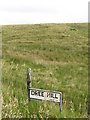
1
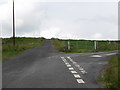
Finnis Road at its junction with Dree Hill
Image: © Eric Jones
Taken: 23 Aug 2011
0.06 miles
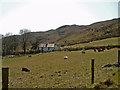
3
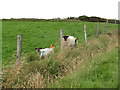
Sheep on improved grazing land on the north side of Dree Hill
Image: © Eric Jones
Taken: 23 Aug 2011
0.06 miles
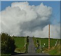
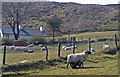
5
Rough grazing land at junction of Dree Hill and Finnis Road
Image: © Eric Jones
Taken: 23 Aug 2011
0.06 miles
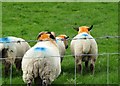
8
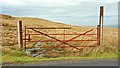
Gate near Finnis
It leads from the Dree Hill road Image to some wet moorland.
Image: © Albert Bridge
Taken: 16 Feb 2009
0.14 miles
9
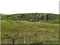
Disused quarry on the west side of Dree Hill
Image: © Eric Jones
Taken: 23 Aug 2011
0.16 miles
10
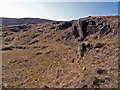
Old quarry at the top of the Rib Road
Image: © Ian R Maxwell
Taken: 1 Apr 2007
0.19 miles