IMAGES TAKEN NEAR TO
Ribadoo Road, CASTLEWELLAN, BT31 9SX
Introduction
This page details the photographs taken nearby to Ribadoo Road, BT31 9SX by members of the Geograph project.
The Geograph project started in 2005 with the aim of publishing, organising and preserving representative images for every square kilometre of Great Britain, Ireland and the Isle of Man.

There are currently over 7.5m images from over14,400 individuals and you can help contribute to the project by visiting https://www.geograph.org.uk
Image Map
Images are licensed for reuse under creativecommons.org/licenses/by-sa/2.0
Notes
- Clicking on the map will re-center to the selected point.
- The higher the marker number, the further away the image location is from the centre of the postcode.
Image Listing (18 Images Found)
Images are licensed for reuse under creativecommons.org/licenses/by-sa/2.0
Image
Details
Distance
1
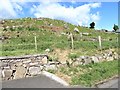
Rock outcrops on the west side of Ribadoo Road
Image: © Eric Jones
Taken: 7 Jun 2017
0.03 miles
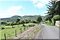
3
Housing on Ribadoo Road
There is a linear pattern of settlement along this road.
Image: © Eric Jones
Taken: 1 Sep 2011
0.05 miles
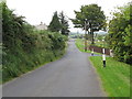
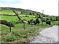
4
Ribadoo Road descending into the Leitrim River valley
Image: © Eric Jones
Taken: 19 May 2016
0.05 miles
5
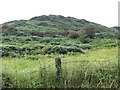
The bracken covered Annagh Hill
This is an eastern spur of the Carrivmoragh Hill.
Image: © Eric Jones
Taken: 1 Sep 2011
0.05 miles
6
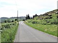
Bend in the Ribadoo Road
Here the road skirts the rocky slopes of The Annagh.
Image: © Eric Jones
Taken: 19 May 2016
0.06 miles
7
Lane linking a homestead high on Clonvaragh Mountain with Ribadoo Road
Image: © Eric Jones
Taken: 19 May 2016
0.10 miles
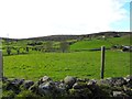
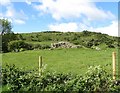
8
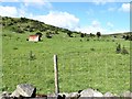
Rough grazing on the eastern slopes of The Anagh
Image: © Eric Jones
Taken: 7 Jun 2017
0.10 miles
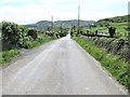
9
View south along Ribadoo Road
The road is descending towards the Leitrim Valley.
Image: © Eric Jones
Taken: 7 Jun 2017
0.11 miles
10
Roche moutonn?e on the west side of Ribadoo Road
A roche moutonnée is a glacially abraded piece of bedrock, smoothed and striated by ice that has flowed over it.
Image: © Eric Jones
Taken: 7 Jun 2017
0.11 miles