IMAGES TAKEN NEAR TO
Lairds Road, CASTLEWELLAN, BT31 9QH
Introduction
This page details the photographs taken nearby to Lairds Road, BT31 9QH by members of the Geograph project.
The Geograph project started in 2005 with the aim of publishing, organising and preserving representative images for every square kilometre of Great Britain, Ireland and the Isle of Man.

There are currently over 7.5m images from over14,400 individuals and you can help contribute to the project by visiting https://www.geograph.org.uk
Image Map
Images are licensed for reuse under creativecommons.org/licenses/by-sa/2.0
Notes
- Clicking on the map will re-center to the selected point.
- The higher the marker number, the further away the image location is from the centre of the postcode.
Image Listing (2 Images Found)
Images are licensed for reuse under creativecommons.org/licenses/by-sa/2.0
Image
Details
Distance
1
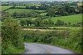
Laird's Road near Katesbridge
Laird’s Road is a minor road off Doyle’s Road Image The view is back towards Doyle’s Road.
Image: © Albert Bridge
Taken: 2 Sep 2007
0.17 miles
2
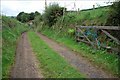
Footpath near Katesbridge
Image: © Albert Bridge
Taken: 2 Sep 2007
0.17 miles