IMAGES TAKEN NEAR TO
Dundrinne Close, CASTLEWELLAN, BT31 9FA
Introduction
This page details the photographs taken nearby to Dundrinne Close, BT31 9FA by members of the Geograph project.
The Geograph project started in 2005 with the aim of publishing, organising and preserving representative images for every square kilometre of Great Britain, Ireland and the Isle of Man.

There are currently over 7.5m images from over14,400 individuals and you can help contribute to the project by visiting https://www.geograph.org.uk
Image Map
Images are licensed for reuse under creativecommons.org/licenses/by-sa/2.0
Notes
- Clicking on the map will re-center to the selected point.
- The higher the marker number, the further away the image location is from the centre of the postcode.
Image Listing (61 Images Found)
Images are licensed for reuse under creativecommons.org/licenses/by-sa/2.0
Image
Details
Distance
1
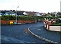
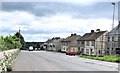
Station Road, Castlewellan
Station Road, Castlewellan. Part of the Newcastle Way - if following it, this is where you enter the town.
Image: © Rossographer
Taken: 5 Nov 2014
0.02 miles
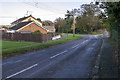
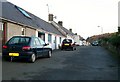
2
Station Road, Castlewellan
This view shows the junction with Dundrinne Road on the right.
Image: © Eric Jones
Taken: 8 Nov 2010
0.04 miles
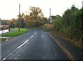
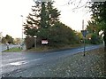
3
The north end of Dundrinne Road
Dundrinne Road leads south to serve a very rural area.
Image: © Eric Jones
Taken: 8 Nov 2010
0.06 miles
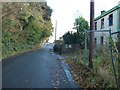
5
The entrance into Station Road from Mill Hill (A25)
Castlewellan had a railway station between 1906 and 1955.
Image: © Eric Jones
Taken: 8 Nov 2010
0.10 miles
6
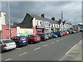
Shops facing Castlewellan's Upper Square
Image: © Eric Jones
Taken: 10 Apr 2019
0.10 miles
7
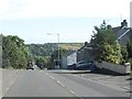
Descending Mill Hill in the direction of Annesborough
Image: © Eric Jones
Taken: 28 Aug 2014
0.10 miles
8

The Drumbuck Road junction on Mill Hill, Castlewellan
Image: © Eric Jones
Taken: 20 Sep 2021
0.10 miles
9
Blue Row, Mill Hill
The terraced cottages of Blue Row were built to house workers of the Annesley Estate at the end of the 18thC.
Image: © Eric Jones
Taken: 8 Nov 2010
0.11 miles