
IMAGES TAKEN NEAR TO
Grove Gardens, DOWNPATRICK, BT30 9RS
Introduction
This page details the photographs taken nearby to Grove Gardens, BT30 9RS by members of the Geograph project.
The Geograph project started in 2005 with the aim of publishing, organising and preserving representative images for every square kilometre of Great Britain, Ireland and the Isle of Man.

There are currently over 7.5m images from over14,400 individuals and you can help contribute to the project by visiting https://www.geograph.org.uk
Image Map
Images are licensed for reuse under creativecommons.org/licenses/by-sa/2.0
Notes
- Clicking on the map will re-center to the selected point.
- The higher the marker number, the further away the image location is from the centre of the postcode.
Image Listing (8 Images Found)
Images are licensed for reuse under creativecommons.org/licenses/by-sa/2.0
Image
Details
Distance
1
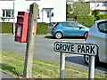
Postbox BT30 753, Killyleagh (May 2017)
Post-mounted EIIR postbox (BT30 753) at Grove Park/Downpatrick Road.
Image: © Albert Bridge
Taken: 1 May 2017
0.10 miles
2
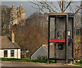
Telephone box, Killyleagh
A telephone box at Kerry Wind off the Downpatrick Road. Killyleagh Castle Image and Image is in the background. The photograph also shows, by accident, that the centre of Killyleagh is in a dip (the valley of the Dibney River).
Image: © Albert Bridge
Taken: 22 Mar 2012
0.15 miles
3

Service Station on the Downpatrick Road
Image: © Mick Garratt
Taken: 4 Aug 2016
0.21 miles
4
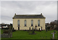
1st Presbyterian Church, Killyleagh, County Down, Northern Ireland
Presbyterian Church in Killyleagh, County Down
Image: © Alf Beard
Taken: 29 Dec 2019
0.23 miles
5
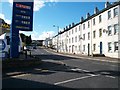
View west along the eastern end of Downpatrick Street
Image: © Eric Jones
Taken: 13 Oct 2012
0.23 miles
6
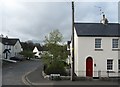
Houses on The Old Mill Estate in Killyleagh
Image: © Eric Jones
Taken: 22 Apr 2017
0.24 miles
7
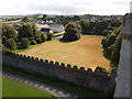
Killyleagh First Presbyterian Church from castle
View from castle tower. The church is just beyond the field in the photo.
Image: © David Hawgood
Taken: 4 Sep 2009
0.24 miles
8
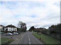
Entering Killyleagh from the south-west along Downpatrick Road
The two road junctions are those with Grove Park (on the left) and Inishmore (on the right)
Image: © Eric Jones
Taken: 17 Apr 2017
0.25 miles