
IMAGES TAKEN NEAR TO
Scollogs Hill Road, DOWNPATRICK, BT30 8TB
Introduction
This page details the photographs taken nearby to Scollogs Hill Road, BT30 8TB by members of the Geograph project.
The Geograph project started in 2005 with the aim of publishing, organising and preserving representative images for every square kilometre of Great Britain, Ireland and the Isle of Man.

There are currently over 7.5m images from over14,400 individuals and you can help contribute to the project by visiting https://www.geograph.org.uk
Image Map
Images are licensed for reuse under creativecommons.org/licenses/by-sa/2.0
Notes
- Clicking on the map will re-center to the selected point.
- The higher the marker number, the further away the image location is from the centre of the postcode.
Image Listing (8 Images Found)
Images are licensed for reuse under creativecommons.org/licenses/by-sa/2.0
Image
Details
Distance
1
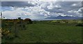
The Mournes from Scollogs
The Mourne Mountains from Scollogs Hill. I had come here looking for a trig pillar (Scollogs - FB OSNIBM 2085) but it appears to be completely hidden in the impenetrable gorse to the left of picture. I will return with a saw!
Image: © Rossographer
Taken: 20 May 2017
0.05 miles
2

Scollogs Hill Road at its junction with Corbally Road
Image: © Eric Jones
Taken: 4 Oct 2011
0.13 miles
3
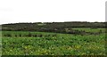
The whin-covered Scollogs Hill, Ballylucas
The hilly land is used mainly as grazing land.
Image: © Eric Jones
Taken: 4 Oct 2011
0.15 miles
4
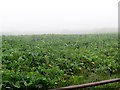
A field of beet south of the Corbally Road
Image: © Eric Jones
Taken: 29 Sep 2011
0.16 miles
5

The Junction of Corbally Road with Scollogs Hill Road
Scollogs Hill Road leads down to the sea, the source of today's thick mist. The Ulster-Scots term for such a mist is "haar".
Image: © Eric Jones
Taken: 29 Sep 2011
0.18 miles
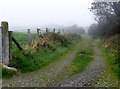
8

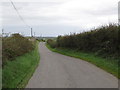
Corbally Road north of the junction with Scollogs Hill Road
This road leads north to the A25 (Downpatrick Road)
Image: © Eric Jones
Taken: 29 Sep 2011
0.23 miles